On a Central Oregon summer afternoon, a brilliant blue morning can turn into towering thunderheads over the Cascades by two o'clock and a lightning storm by four. These sudden afternoon thunderstorms are a hallmark of high-desert summer, and they form through a reliable daily process: the sun heats the surface, warm air rises over the mountains, and where there is enough moisture it builds into towering clouds that unleash lightning, gusty winds, and brief downpours. They are most common from late spring through summer, they fire in the afternoon and evening, and they can be hazardous to hikers, climbers, and boaters caught in the open.
Why Do Thunderstorms Form in the Afternoon?
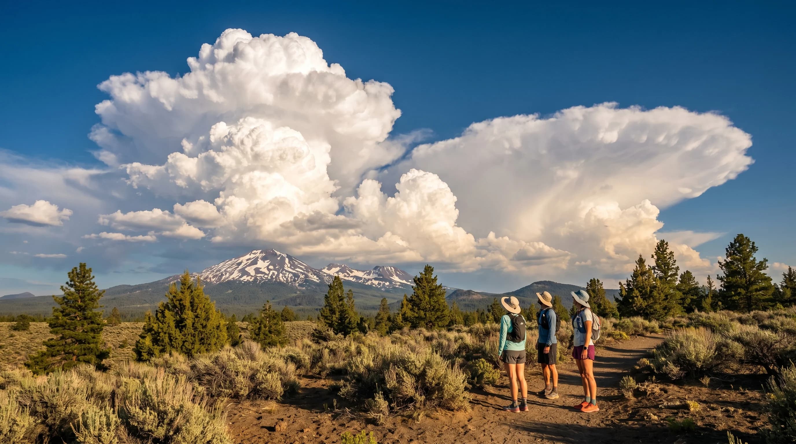
Central Oregon's summer thunderstorms form in the afternoon because they are powered by daytime heating, which takes hours to build the rising air that fuels them. Through the morning, the sun heats the ground, and warm air near the surface becomes buoyant and begins to rise, a process called convection. As that warm air rises, it cools, and its moisture condenses into cumulus clouds. Given enough heating and moisture, those fair-weather cumulus grow upward through the afternoon into towering cumulonimbus, the classic thunderhead.
This is why the storms follow such a predictable daily clock: mornings are usually clear, the clouds build through midday, and the storms peak in the heat of the afternoon and early evening before fading after sunset as the heating shuts off. The same strong daytime heating that drives the region's gusty afternoon winds also drives the convection, so the windy and stormy afternoons share a root cause, the heating covered in why Bend afternoons get gusty.
The Role of the Cascades and Mountains
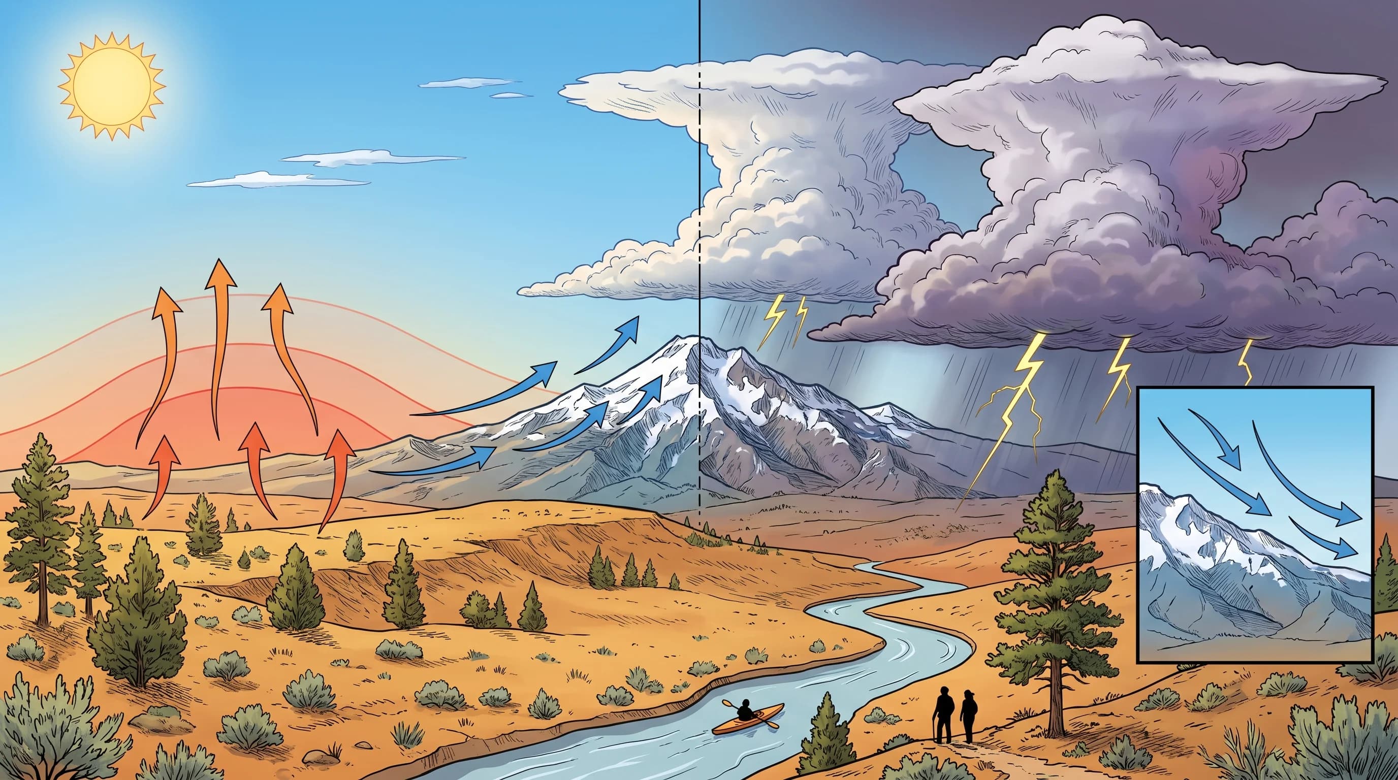
The Cascades and the region's high terrain are favored launch points for thunderstorms, because mountains heat up fast and force air upward, giving convection a head start. Sun-facing slopes warm quickly and become hot spots that send warm air rising, and the terrain itself mechanically lifts air as it flows against the mountains, a process called orographic lift, covered in what is orographic lift. Both effects give the rising air the extra nudge it needs to grow into storms.
This is why storms so often build over the Cascades and the high country first, then sometimes drift out over the lower desert. It is also why a hiker high in the mountains can be in a thunderstorm while town stays sunny, and why the high country demands extra caution on summer afternoons. The mountains essentially manufacture their own weather, concentrating the convection where the terrain is highest and the heating most intense.
Where the Moisture Comes From
Thunderstorms need moisture as well as heat, and in dry Central Oregon that moisture usually has to be imported, which is why the storms come in episodes rather than every day. The high desert is arid thanks to the Cascade rain shadow, so on a typical hot day there is plenty of heating but not enough moisture to build big storms, and the afternoon clouds stay shallow. Real thunderstorm outbreaks happen when a surge of moisture moves into the region, often monsoon moisture pulled up from the south or moisture riding in ahead of a weather system.
When that moisture arrives and combines with the strong summer heating, the atmosphere becomes unstable enough for towering storms. This is why thunderstorms tend to come in multi-day spells when the pattern is right, then disappear for stretches of dry, stable heat. The episodic nature, and the fact that the moisture often comes from far away, makes the exact timing of storms hard to predict more than a day or two out, even though the daily afternoon rhythm is reliable when the moisture is present.
How Dangerous Are Summer Thunderstorms?
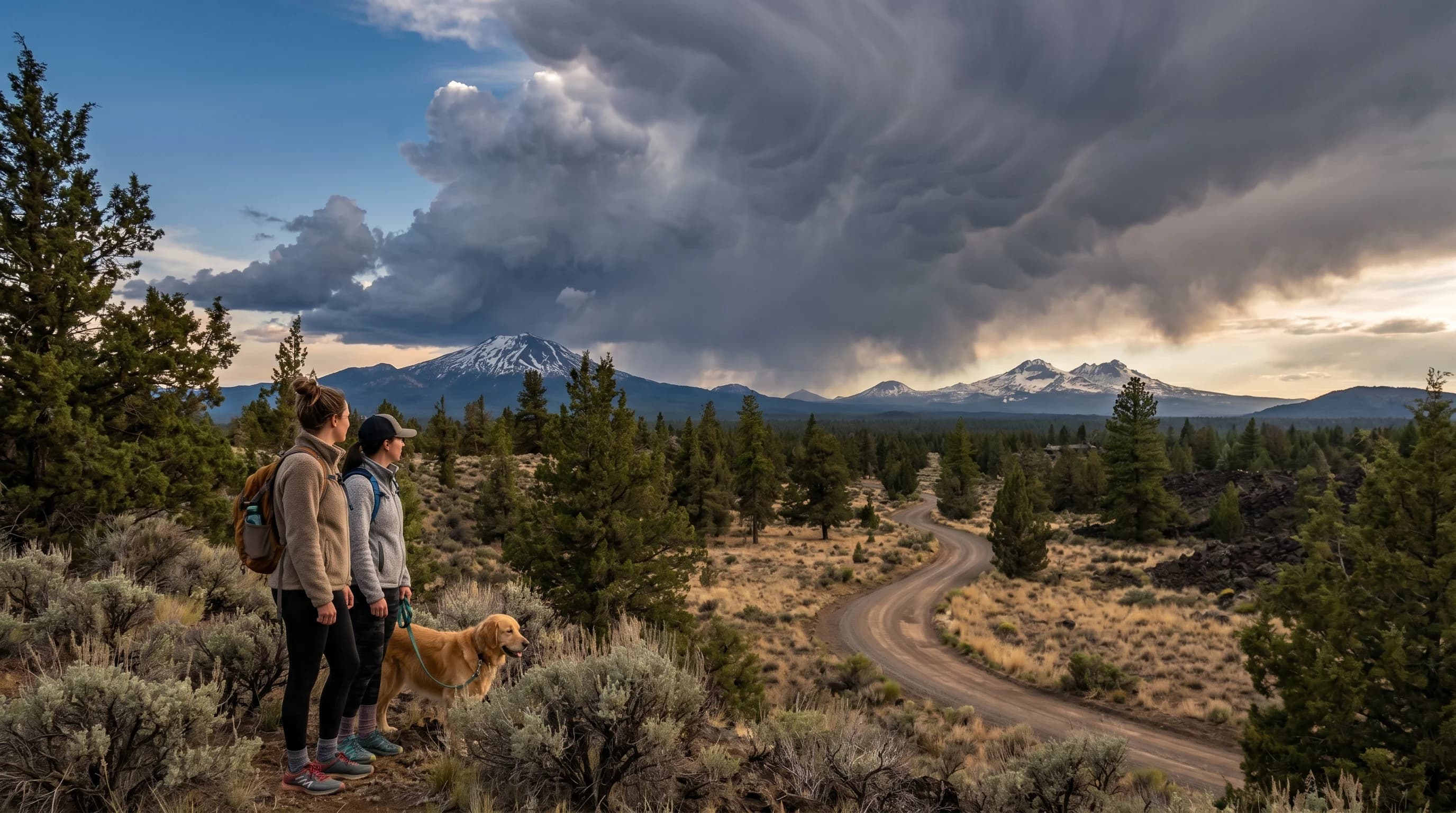
Central Oregon's summer thunderstorms can be genuinely dangerous, bringing lightning, strong gusty winds, brief heavy rain, small hail, and the risk of starting wildfires. Lightning is the most direct hazard, especially for hikers and climbers on exposed ridges and peaks and for boaters and paddlers out on open water, all of whom are dangerously exposed when a storm fires. The safety essentials for the high country and the lakes are covered in lightning safety for hikers and lakes.
Beyond lightning, the storms' strong downdraft winds can hit suddenly and turn a calm lake into whitecaps or knock down branches, and in the dry high desert, lightning from storms that produce little rain is a leading cause of new wildfires. These dry thunderstorms are a special concern for fire weather. The brief but intense nature of the storms, and how fast they can develop, means conditions can change dramatically within an hour, so summer afternoons in the high country call for constant attention to the sky.
How to Stay Safe and Plan Around Them
The best strategy for Central Oregon's summer thunderstorms is to start early and be off exposed terrain and open water by early afternoon, when storms are most likely to fire. Plan big hikes, climbs, and paddles for the morning, watch the forecast for thunderstorm chances, and keep an eye on the sky, since building cumulus through midday is the warning sign that afternoon storms are developing. If you hear thunder, the storm is already close enough to be a lightning threat, and it is time to get off ridges, peaks, and water.
The good news is the daily rhythm makes the storms reasonably predictable: morning is almost always the safe window, and the danger builds in the afternoon. With an early start and an eye on the clouds, summer thunderstorms are manageable, and they add a dramatic beauty to high- desert summer. For how they fit the season, see the May weather guide where the season begins, and the Central Oregon climate guide.