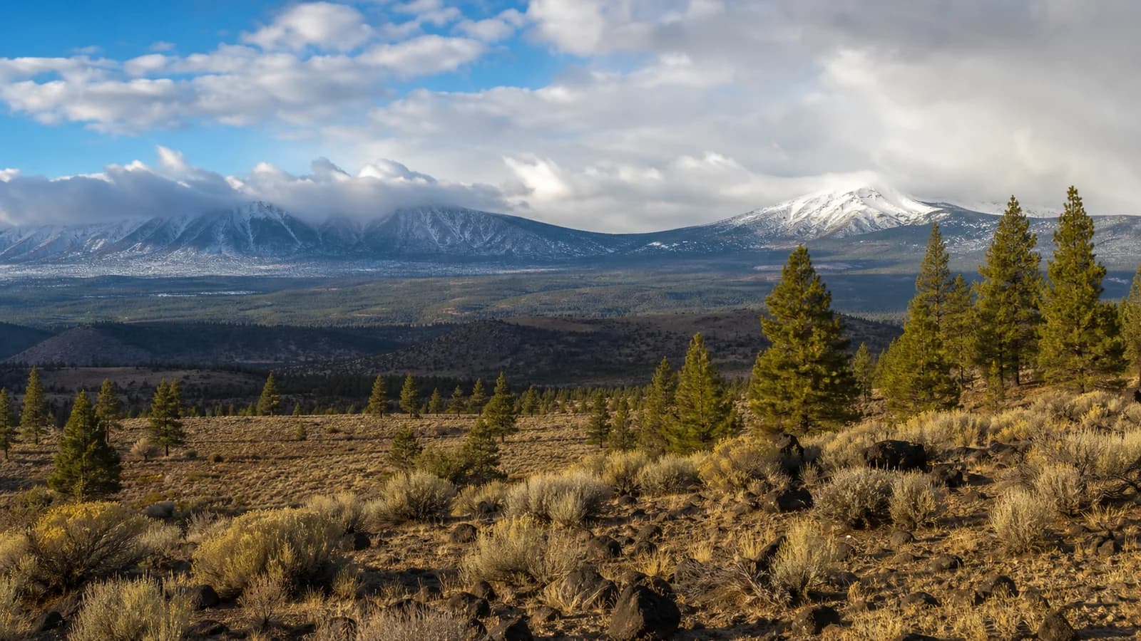
Central Oregon has a high-desert climate shaped by the Oregon Cascades. The mountains pull moisture out of Pacific storms before that air reaches Bend, Redmond, and Madras, leaving the east side sunnier, drier, windier, and more prone to large day-to-night temperature swings. That is why Central Oregon can have snow on the Cascade crest, dry pavement in town, a warm afternoon, and a freezing morning all in the same weather pattern.
What Climate Does Central Oregon Have?
Central Oregon is best understood as a dry, high-elevation desert climate with strong mountain influence, the kind of climate geographers call high desert or cold desert. It is defined by three things working together: very low rainfall, big swings in temperature, and abundant sunshine. Annual precipitation in the lower towns runs only around 10 to 12 inches, a fraction of what falls just over the mountains to the west, and the region averages close to 300 days a year with measurable sun. The lower towns sit on the leeward, sheltered side of the Oregon Cascades, while nearby recreation areas climb quickly into colder, snowier terrain.
Elevation is the second half of the story. Bend sits around 3,600 feet, high enough that it is meaningfully cooler and more exposed than a sea-level city at the same latitude. Sunriver and La Pine sit higher still and often run colder at night, while Mt. Bachelor is a different weather world entirely, with a base above 6,000 feet and summit conditions above 9,000 feet. Being far from the moderating ocean, a property called continentality, adds to the extremes: without the sea's steadying influence, the high desert heats up and cools down more freely than the coast ever does.
That vertical range is the core reason generic regional forecasts feel incomplete here. A forecast that is comfortable for the Deschutes River Trail can be icy at Mt. Bachelor. A sunny afternoon in Redmond can still become a hard freeze in La Pine before sunrise. Central Oregon climate is not one uniform setting, it is a stack of elevation bands, terrain exposures, and cold basins, each behaving a little differently in the same storm.
Why the Oregon Cascades Create a Dry Rain Shadow
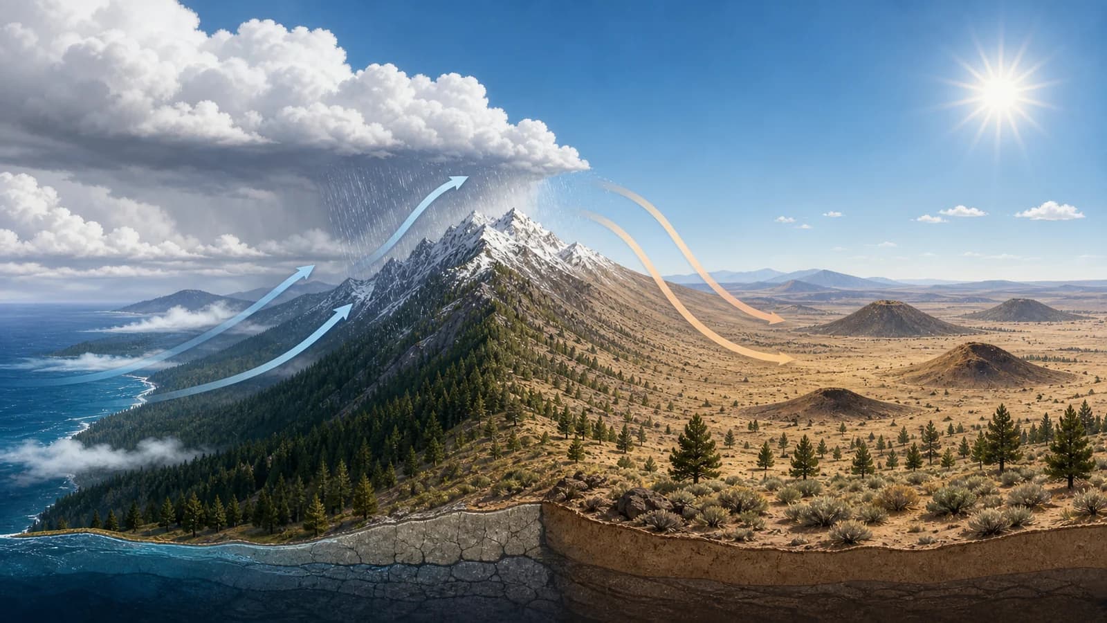
The Oregon Cascades create Central Oregon's rain shadow. Pacific storms arrive from the west, rise over the Cascade crest, cool, and drop much of their moisture as rain or snow on the west side and along the mountains. By the time that air descends toward Sisters, Bend, Redmond, and Madras, it is drier and often warmer.
The mechanism is straightforward physics. As moist Pacific air is forced up the windward slopes, it cools at a predictable rate, and cooler air cannot hold as much water vapor, so the moisture condenses and falls as rain and snow on the west side and crest. Air that descends the eastern side has already been wrung out, and as it sinks it compresses and warms, which actively discourages new clouds from forming. The west slopes can collect well over 100 inches of precipitation a year while Bend gets barely a tenth of that.
This is why the region can be so dry while the nearby mountains build a deep winter snowpack. The same storm can produce heavy snow near the Cascade crest, lighter snow or rain in Bend, and very little precipitation farther east toward Madras or Prineville. That snowpack is not just scenery, it is the region's water supply, slowly melting through spring and summer to feed the rivers. For a closer look at the sunshine side of the same pattern, see why Bend is sunnier than Portland and the Willamette Valley, and for the mechanism itself, see the Oregon Cascades rain shadow.
Why Temperatures Swing So Much Between Day and Night
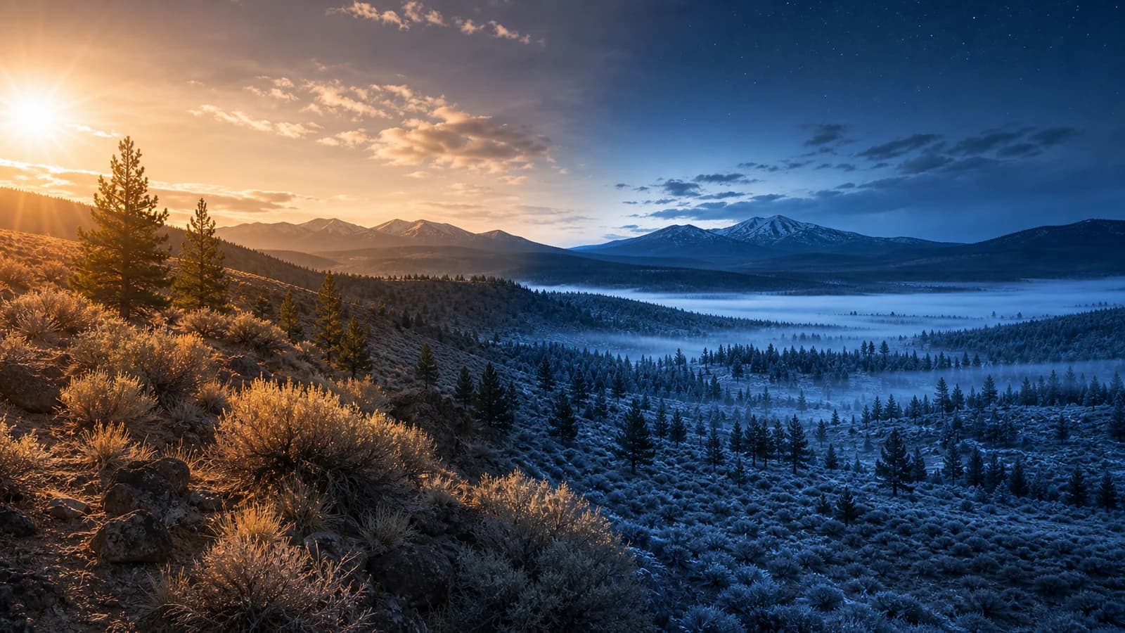
Central Oregon's day-to-night temperature swing, which can run 30 to 45 degrees in summer, comes down to dry air and clear skies. Humid air holds heat well, because water vapor absorbs and re-radiates the heat the ground gives off at night, acting like a blanket. The high desert's dry air has very little of that blanket, so once the sun goes down, the ground radiates its heat straight up and out to space with nothing to hold it near the surface. Clear skies, which the rain shadow provides in abundance, make the heat loss even more efficient.
Terrain finishes the job. On calm nights, the cold, dense air that forms near the ground flows downhill and pools in basins and low spots, so the coldest readings collect in places like La Pine and Sunriver while a slope a few hundred feet up stays warmer. The result is the classic high-desert pattern: a comfortable, even hot afternoon followed by a startlingly cold morning. The same nightly cooling is why borderline winter storms can shift between freezing rain, sleet, and snow, and the full mechanism gets its own treatment in why Central Oregon has such big temperature swings.
Practically, the swing matters for almost everyone outdoors. It catches campers at the Cascade Lakes who packed for the afternoon, drives the frost dates that constrain high-desert gardens, and surprises summer visitors who assumed a warm day meant a warm evening. In Central Oregon, shorts weather at 3 p.m. does not guarantee shorts weather at 7 a.m., and a light layer for the evening is a year-round habit.
How Elevation Changes Weather Across Central Oregon
Elevation changes temperature, precipitation type, wind exposure, and snow persistence. A rough rule is that temperature drops several degrees for each 1,000 feet of elevation gain, but local humidity, cloud cover, wind, and storm track all adjust the actual number. That is why snow level matters so much in winter forecasts: a snow level near 5,000 feet leaves Bend mostly wet, while the same storm can cover higher trailheads and ski areas.
Elevation also explains why recreation planning needs more precision here than in flatter regions. Smith Rock can be hot and exposed while the Cascade Lakes are cool and windy. Paulina Peak can be cold and stormy while Bend is dry. Central Oregon weather changes fast because the land rises and falls fast.
Does Central Oregon Have Four Seasons?
Yes, but they do not behave like the four seasons of a humid or coastal climate. Winter is cold and snowy, with the basins prone to freezing fog and hard overnight lows, and the real snow stacking up in the Cascades rather than in town. Spring is the most changeable season, alternating warm sun, late snow, and the region's windiest stretches as the atmosphere transitions. The dry air keeps spring nights cold long after the afternoons turn pleasant.
Summer is hot, bright, and very dry, with afternoon highs that can reach the upper 80s and low 90s giving way to nights in the 40s, plus two summer hazards the coast rarely sees: afternoon thunderstorms building over the mountains and wildfire smoke that can drift in for days. Fall is many locals' favorite, with clear, crisp, settled days, cool nights, and the first frosts and mountain snow returning by October. Across all four, the constants are dryness, sunshine, and the daily temperature swing.
What This Climate Means for Trips and Outdoor Days
The practical rule is simple: plan by elevation, exposure, and time of day. In winter, check snow level and road ice. In spring, expect freeze-thaw cycles and muddy trails. In summer, account for heat, UV, wind, smoke, and cold lake water. In fall, expect excellent clear days mixed with frost risk and early snow in the mountains.
Central Oregon's climate is part of its appeal. The same dry air that makes nights cold also helps create sunny winter afternoons. The same mountains that block rain also create snow for skiing and summer water supply. Once you see the region as a high desert tucked against a snowy mountain wall, the fast weather changes start to make sense.