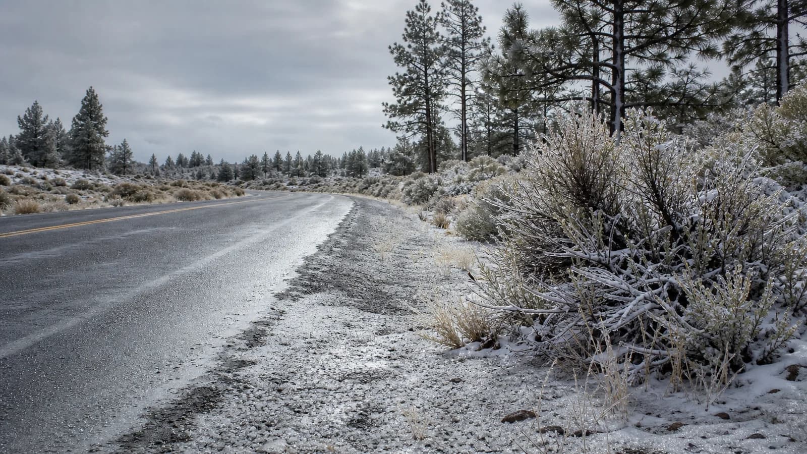
Freezing rain, sleet, and snow all start the same way, as snow forming high in a winter cloud, but they reach the ground as three very different hazards. What separates them is not the cloud. It is the stack of warm and cold air layers the falling precipitation passes through on the way down. Snow stays frozen the whole trip. Sleet melts partway, then refreezes into ice pellets. Freezing rain melts completely and stays liquid until it touches a surface below freezing, where it turns to glaze ice on contact. In Central Oregon, where cold air pools in the basins while warmer air slides in aloft, that difference can decide whether a drive across Bend is merely slushy or genuinely dangerous.
How All Winter Precipitation Starts as Snow
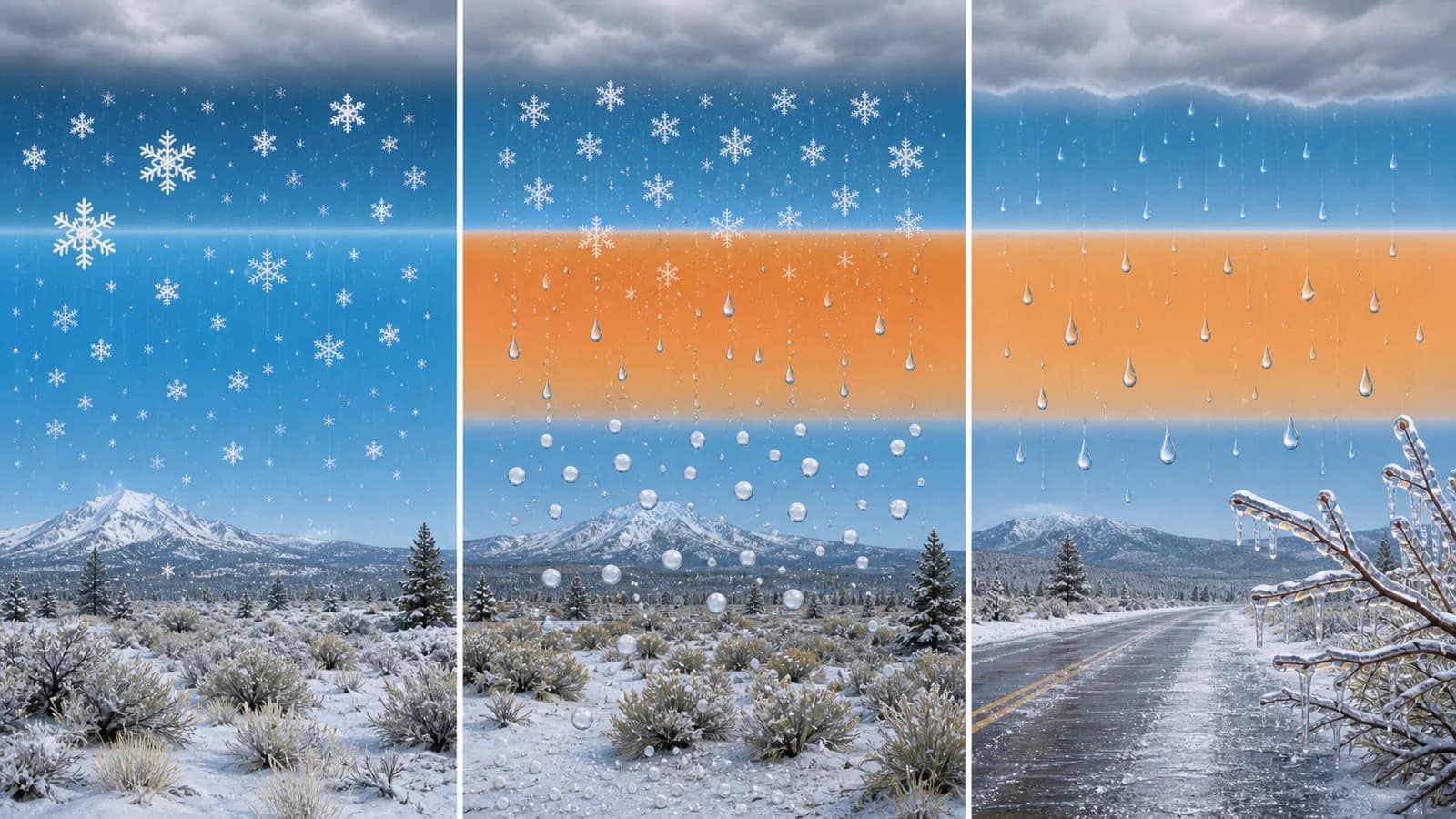
Almost all precipitation in a Pacific Northwest winter begins as snow, even the rain. High in the cloud, where temperatures sit well below freezing, water vapor freezes onto tiny particles and grows into ice crystals and snowflakes. What happens next is entirely about temperature layers between that cloud and the ground. Meteorologists read those layers as a vertical temperature profile, and the depth and warmth of each layer is what sorts the falling snow into the three familiar winter types.
Two temperatures matter most. The air temperature aloft decides whether the snowflake melts on the way down, and the surface temperature, especially the temperature of the road itself, decides what happens when it lands. A third factor, the wet-bulb temperature, captures how evaporation cools the air as the first precipitation falls into it. Dry high-desert air can drive the wet-bulb temperature several degrees below the plain thermometer reading, which is why Central Oregon can flip from rain to snow faster than the air temperature alone suggests.
Snow: When the Whole Column Stays Below Freezing
Snow reaches the ground as snow when the entire air column from cloud to surface stays at or below freezing. The snowflakes that form aloft never pass through a warm enough layer to melt, so they keep their crystal structure all the way down. The exact shape and texture depends on temperature: very cold air produces small, dry, powdery flakes, while temperatures near freezing produce large, wet, clumping flakes that stick together and pile up fast.
Snow is the most familiar of the three and often the most manageable. It reduces traction, but it is visible, it is plowable, and it gives drivers a clear signal to slow down. The catch in Central Oregon is elevation. Snow level, the height at which falling snow survives to the ground instead of melting, can sit right at town elevation, so the same storm drops snow at higher Sunriver while lower Redmond gets rain. When snow does fall and then the temperature drops on a clear night, the packed surface can refreeze into a hard, slick layer that behaves more like ice than fresh powder.
Sleet: Snow That Melts, Then Refreezes
Sleet forms when a snowflake falls through a shallow warm layer, melts partway or completely into a raindrop, and then passes through a deep enough cold layer near the surface to refreeze into a small, hard ice pellet before it lands. The telltale sign is the sound and the bounce: sleet rattles off windshields and roofs and skitters across pavement rather than splatting like rain or settling like snow.
The key ingredient is a cold surface layer that is thick enough to refreeze the drop in mid-air. If that layer is deep, you get sleet. If it is shallow, the drop does not have time to refreeze and you get freezing rain instead, which is why sleet and freezing rain so often trade places during the same storm. Sleet can accumulate into a slushy, pelletized layer that is slick underfoot and under tire, but because it is visible and granular, it usually gives more warning than the clear glaze of freezing rain. Sleet is not the same as snow, even though both are frozen: snow stays a crystal the whole way down, while sleet is a melted-then- refrozen pellet. Soft, white pellets that crumble in your hand are a third thing, graupel.
Freezing Rain: Liquid That Freezes on Contact
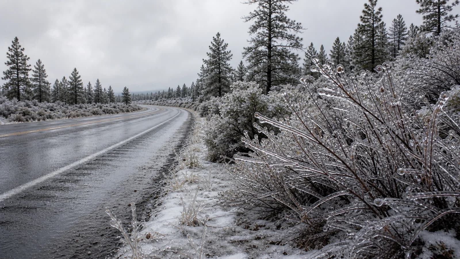
Freezing rain is the most dangerous of the three because it arrives as liquid and only turns to ice once it touches something. It forms when a snowflake melts completely in a warm layer aloft and then falls through a cold surface layer that is too shallow to refreeze it in the air. The drop stays liquid, but it is supercooled, meaning it is colder than freezing yet still liquid, and the instant it lands on a road, bridge, branch, or windshield that is at or below 32 degrees, it freezes into a smooth, clear coating called glaze ice.
That glaze is what makes freezing rain so hazardous. It is nearly invisible, so drivers see what looks like wet pavement and have no warning that the surface is closer to an ice rink. It bonds to everything uniformly, so there is no granular texture to grip. And it builds up: a long freezing-rain event can accumulate enough ice to bring down tree limbs and power lines under the weight. Bridges, overpasses, and shaded roads ice first because they lose heat from above and below and stay colder than the surrounding ground. A road can look perfectly drivable and still be glazed, which is the single most important thing to understand about freezing rain.
Why Central Oregon Sees All Three in One Storm
Central Oregon is unusually good at producing mixed winter precipitation because it combines a big elevation range with basins that trap cold air. On clear, calm nights, dense cold air drains downhill and pools in the Deschutes Basin, leaving a shallow but stubborn cold layer near the surface. When a warmer Pacific system then slides in aloft, the setup is perfect for the precipitation to melt up high and refreeze, or glaze, down low. This is a classic temperature inversion at work, and it is why a single storm can deliver snow, sleet, and freezing rain within a few miles of each other.
Elevation stacks another variable on top. A storm can produce snow up at Mt. Bachelor, rain in a warmer pocket, and freezing rain or sleet in a colder basin where the surface stays below freezing. Snow level, wet-bulb cooling, and the temperature of the road itself all interact, so the precipitation type can change by elevation, by time of day, and from one basin to the next. That fast, terrain-driven variability is part of why Central Oregon weather changes so fast. It is also closely related to freezing fog, which can glaze roads with ice even when no rain or snow is falling at all.
What Wintry Mix Means for Central Oregon Drivers
When a forecast says wintry mix, it means more than one of these precipitation types is likely in the same storm, and the safest assumption is to prepare for the worst of the three: the glaze ice of freezing rain. A storm that starts as snow can change to sleet and then freezing rain as a warm layer builds aloft, or run the sequence in reverse as it pulls cold air back in. The transitions are where people get caught, because the road can look better than it is.
To read a Central Oregon winter forecast well, look past the single weather icon. Check the hourly temperature trend, the forecast precipitation type, the snow level, and whether temperatures are rising or falling, and pay extra attention to the overnight and early-morning hours when road surfaces are coldest. Rain near freezing is not automatically safe rain; it is often a sign the atmosphere is one or two degrees away from a far more dangerous precipitation type. When freezing rain, sleet, or freezing fog appears in the forecast, treat the travel risk as higher than the precipitation amount alone would suggest, and give bridges, overpasses, and shaded stretches extra respect. In the high desert, the difference between a wet road and an ice rink is often just a few degrees and a few hundred feet of elevation.