Temperature inversions are behind some of Central Oregon's most distinctive and frustrating weather: the cold, gray, foggy winter mornings, the ice that forms without snow, and the smoke and haze that linger in the basin for days. An inversion flips the normal pattern, so that cold air sits trapped near the ground beneath a lid of warmer air above. In the Deschutes Basin, this happens often on calm, clear nights, when cold air drains into the low ground and gets capped, trapping cold, fog, and any pollutants right where people live. Inversions are most common and most stubborn in winter, but they can occur in any season.
What Is a Temperature Inversion?
A temperature inversion is a reversal of the normal atmosphere, in which temperature rises with height instead of falling, so a layer of warm air sits on top of cooler air near the ground. Normally the air is warmest at the surface and cools steadily as you go up, which is why mountaintops are colder than valleys. In an inversion, that order is flipped over a layer: the air near the ground is colder than the air above it, and that warm layer aloft acts like a lid.
That lid is the key to why inversions matter. Warm air is less dense than cold air, so the cold air trapped underneath cannot rise and mix out, and the warm cap suppresses any vertical motion. Whatever is in that trapped layer, cold, fog, smoke, or pollution, stays put, sometimes for days, until a change in the weather breaks the inversion. The basic phenomenon is covered in what is a temperature inversion; this article is about why Central Oregon gets them so often and what they do here.
Why the Deschutes Basin Traps Cold Air

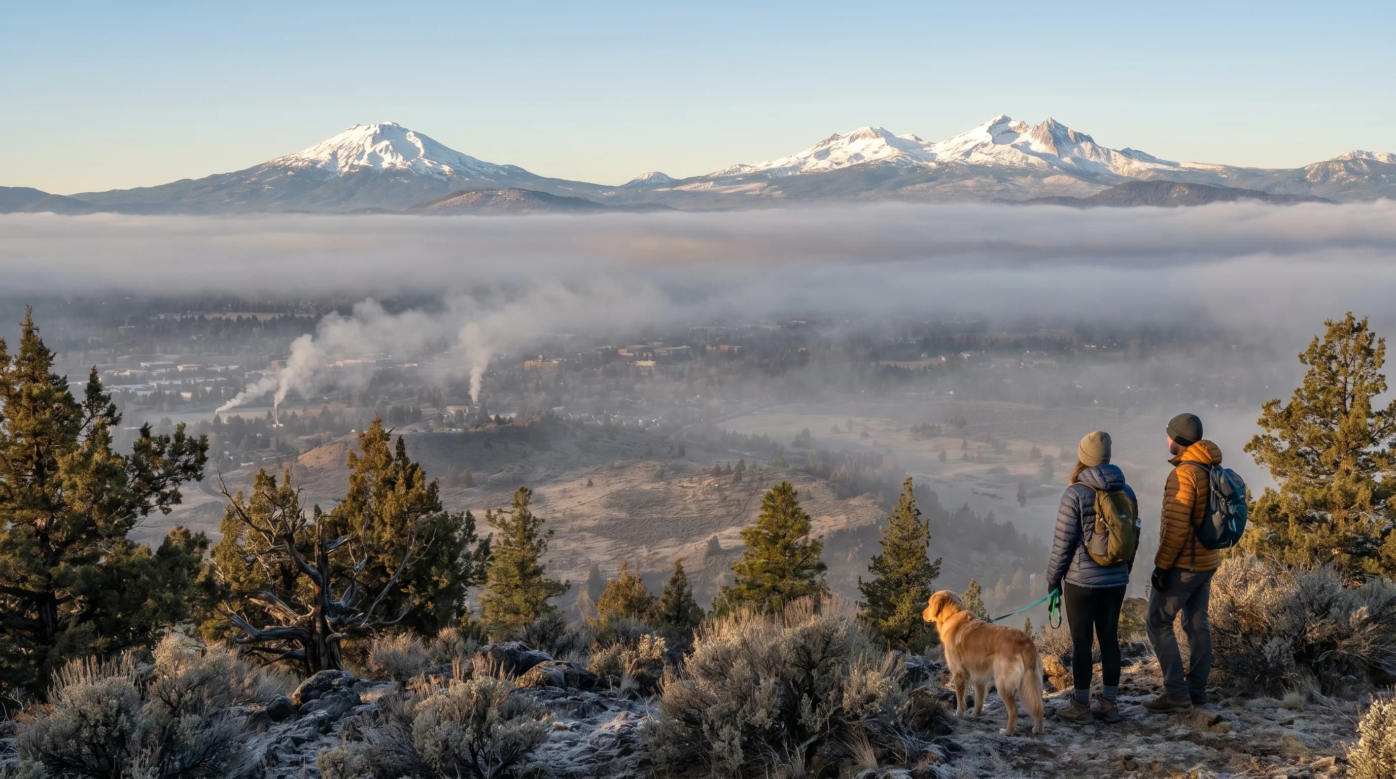
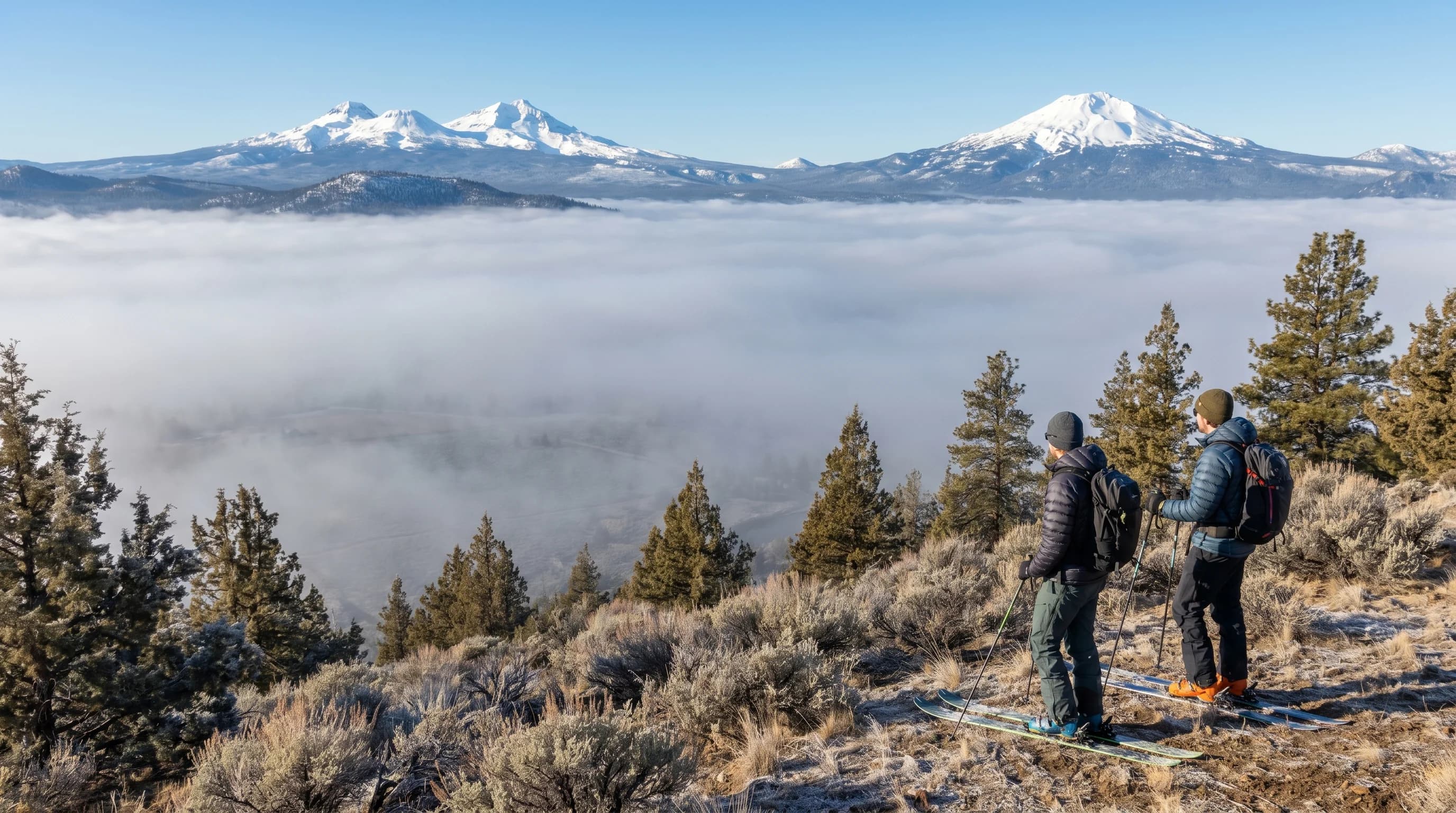
Central Oregon gets frequent inversions because the Deschutes Basin is a bowl that cold air drains into, and the high desert's calm, clear nights are ideal for forming them. The terrain sets it up: Bend, Redmond, and the surrounding basin sit lower than the ground and mountains around them. On clear, calm nights the ground radiates its heat to space and chills the air just above it, and that cold, dense air flows downhill off the higher terrain and pools in the basin, a process called cold-air drainage.
As the cold air settles into the low ground, the air above it stays relatively warmer, and an inversion forms with the coldest air at the very bottom. The clearer and calmer the night, the stronger the cooling and the deeper the cold pool, which is why high-pressure systems, bringing clear skies and light winds, are the classic inversion setup. The same conditions that build inversions also drive the region's big day-to-night temperature swings, since both depend on that rapid radiational cooling on clear, calm nights.
Cold Air, Fog, and Smoke
Inversions are responsible for trapping three things in the Central Oregon basin: cold, freezing fog, and smoke or haze, all held under the warm lid until the weather changes. The cold comes first, as the trapped surface layer keeps chilling overnight and resists warming even after sunrise, since the sun has to heat the whole cold pool before it can break the lid. On short winter days the sun often cannot win, and the basin stays cold and gray while the mountains above sit in sunshine.
When the trapped air is humid and below freezing, the moisture condenses into freezing fog, which glazes roads with ice, covered in freezing fog in Central Oregon. And because the lid prevents mixing, anything emitted into the trapped layer, wood smoke from stoves in winter or wildfire smoke in late summer, accumulates instead of dispersing, degrading air quality. An inversion turns the basin into a closed box, and whatever goes in tends to stay until it lifts.
When Inversions Happen and How They Break
Inversions are most common and most persistent in winter, when long, cold, clear, calm nights give the cold air the most time to pool and the weak winter sun the least power to break the lid. A strong winter high-pressure system can lock an inversion in place for days, producing long stretches of cold, gray, foggy, stagnant weather in the basin while it stays sunny and mild on the peaks. These are the classic Central Oregon winter inversions.
Inversions break when the weather changes enough to mix the atmosphere or strip away the warm lid. Wind is the most reliable breaker, since it stirs the trapped cold air together with the warmer air aloft and erases the layering. An incoming storm or front does the same, replacing the stagnant high-pressure pattern with active, mixing weather. Strong daytime sun can also break a shallow inversion by heating the surface enough to overturn the cold pool, which is why summer inversions usually burn off by midday while deep winter ones can persist. The arrival of wind or a front is the cue that the cold, fog, and smoke are about to clear.
Why Inversions Matter in Central Oregon
Inversions matter because they concentrate Central Oregon's winter hazards and air-quality problems in the basin where people live, while the mountains nearby stay clear. For drivers, the inversion's freezing fog and ice are the practical danger on cold mornings. For anyone with respiratory sensitivity, the trapped wood smoke in winter and wildfire smoke in late summer are a real health concern, since the lid keeps pollution from dispersing. The contrast can be jarring: a smoky, foggy, cold basin under a brilliant sunny sky just a short drive up the mountain.
Understanding inversions explains a lot of the region's seemingly contradictory weather, why it can be colder in town than on the mountain, why fog and smoke linger, and why a windless high-pressure spell that looks like nice weather can actually mean days of gray stagnation in the basin. Watching for calm, clear, high-pressure conditions in winter is the best way to anticipate an inversion and the cold, fog, and haze that come with it. For how this fits the broader picture, see the Central Oregon climate guide.