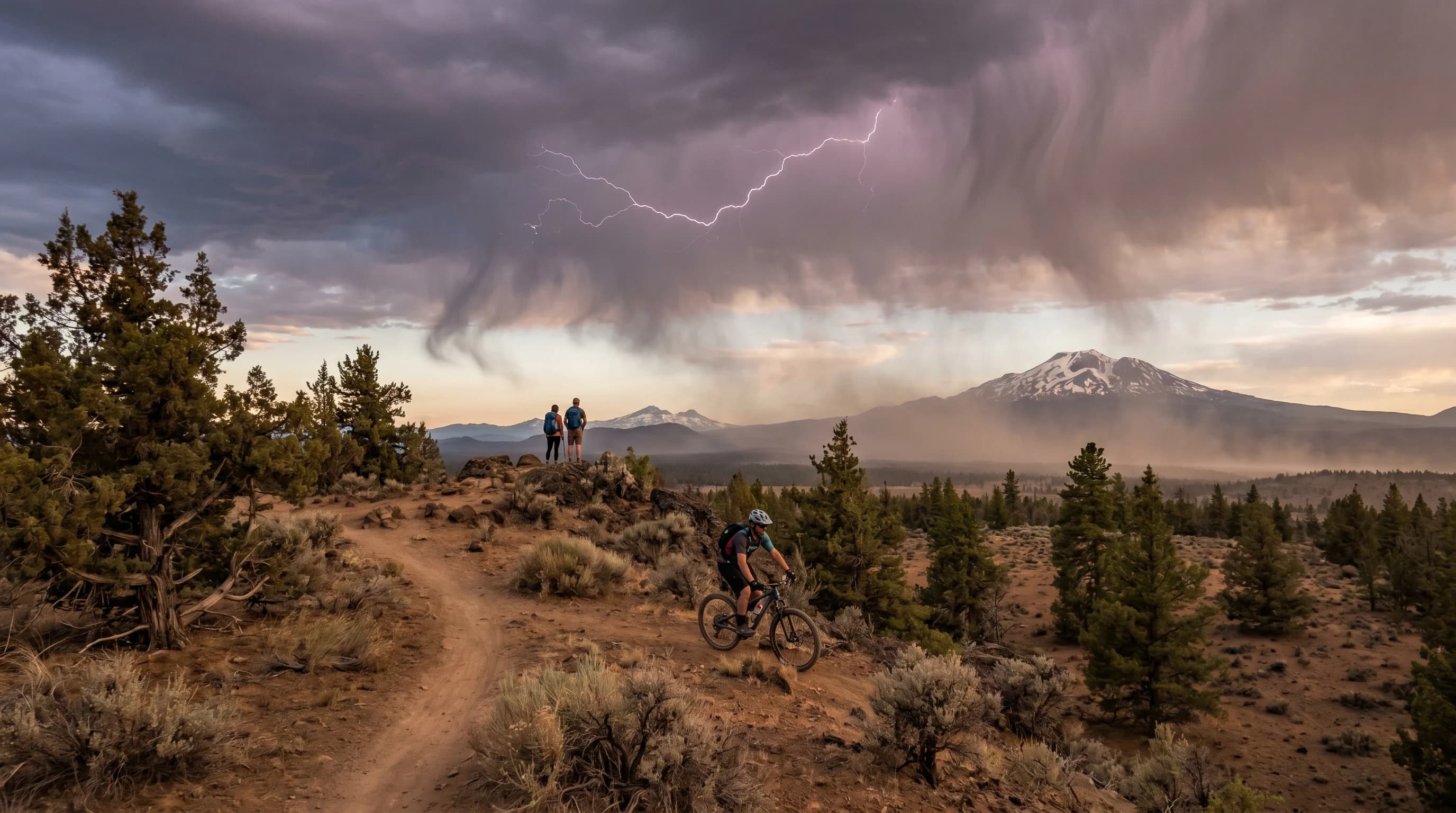
Some of the most dangerous storms in Central Oregon barely rain at all. A dry thunderstorm produces lightning and gusty wind but little or no rain that reaches the ground, and in the arid high desert that combination, ignition without moisture, is a recipe for wildfire. These dry, windy storms are a defining summer fire-weather hazard: the lightning starts fires, the wind fans them, and the dry air ensures there is no rain to put them out. Understanding why Central Oregon's storms so often run dry, and why that makes them so dangerous, is essential to understanding the region's fire season.
What Is a Dry Thunderstorm?
A dry thunderstorm is a storm that produces lightning and gusty wind but whose rain largely evaporates before reaching the ground. The storm itself is real, towering clouds, lightning, downdrafts, but the lower atmosphere is so dry that the falling rain evaporates on the way down, appearing as wispy streaks called virga rather than rain that wets the surface. The result is a storm that delivers all of lightning's danger and none of rain's benefit.
This is a distinctly high-desert phenomenon, tied directly to the region's dry air. The same aridity that produces virga, rain that evaporates before it lands, is what makes a thunderstorm run dry, covered in what is virga. In a humid climate, a thunderstorm's rain reaches the ground and dampens the landscape, reducing fire risk. In Central Oregon's dry air, the rain often never arrives, and the lightning strikes a parched landscape primed to burn.
Why Central Oregon Storms Run Dry
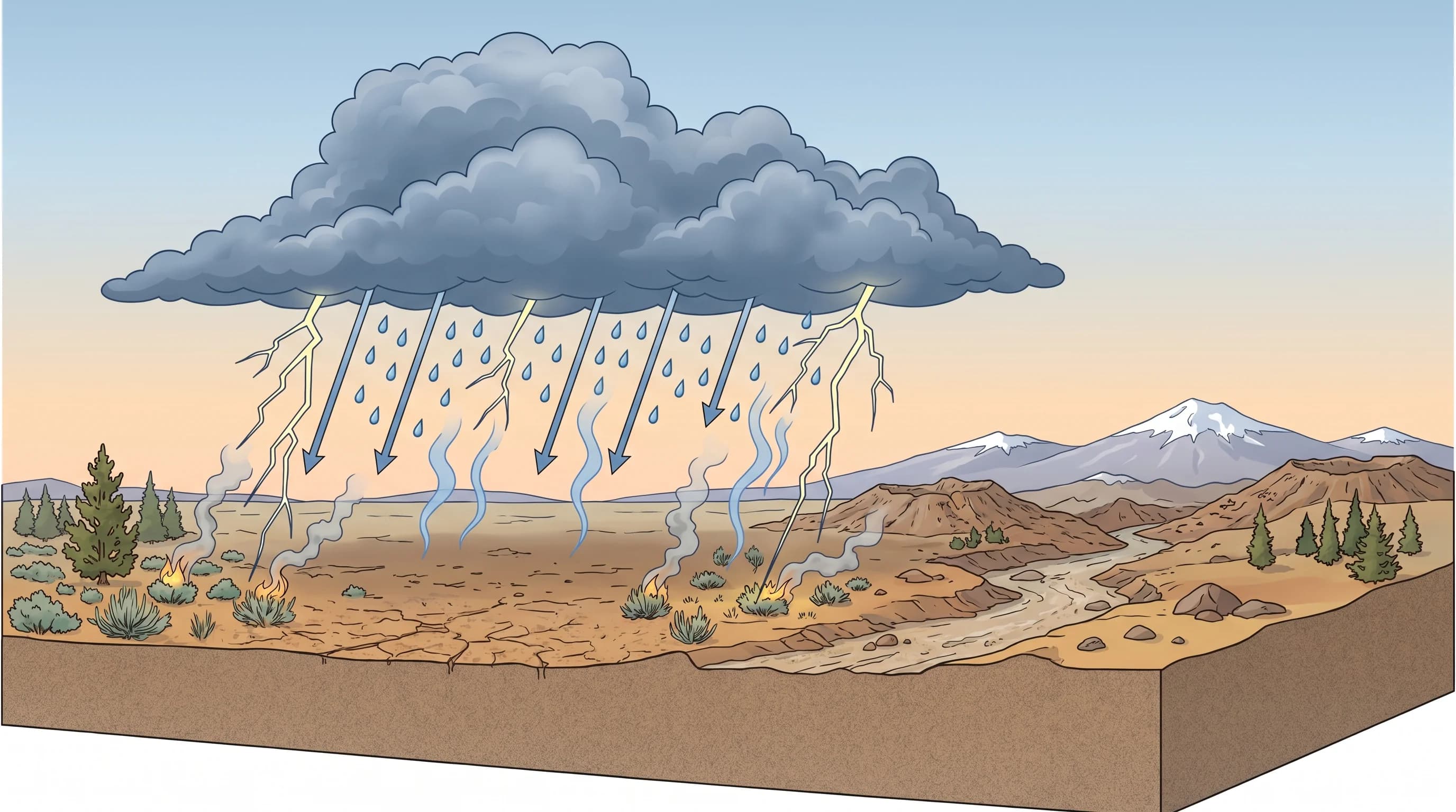
Central Oregon storms run dry because the region's low-level air is so dry that it evaporates falling rain before it can reach the surface. When rain falls from a storm into a deep layer of dry air, the droplets evaporate, and the deeper and drier that layer, the more rain is lost on the way down. The high desert's characteristic dry air, a product of the Cascade rain shadow, means storms here frequently have a thick dry layer beneath them that the rain cannot survive.
The aridity is rooted in the same rain shadow that makes the whole region dry, explained in the Oregon Cascades rain shadow. Compounding it, many of the region's summer storms form from moisture aloft over a dry surface layer, so there is plenty of instability for lightning but little low-level moisture for rain. The lightning, generated high in the storm, reaches the ground regardless, while the rain evaporates, producing the dangerous mismatch of strikes without soaking.
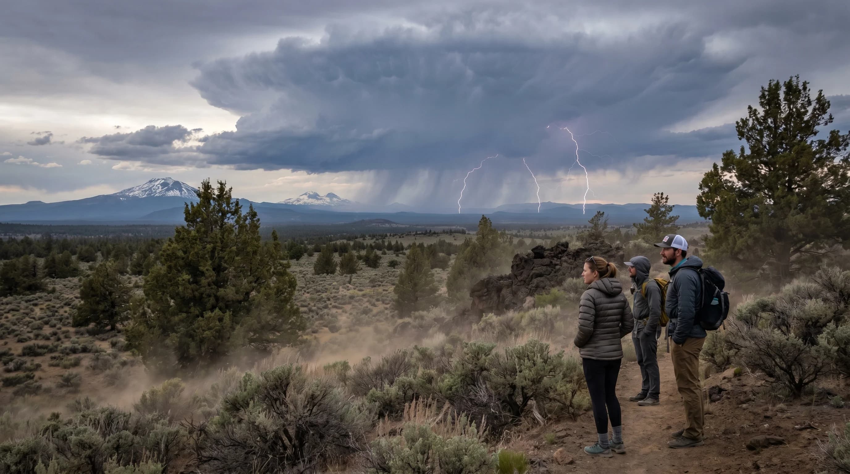
Why the Wind Makes Them Worse
The wind that comes with dry storms is what turns a lightning-started fire into a fast-spreading one, making the storms doubly dangerous. Thunderstorms generate strong downdrafts, columns of air rushing down and out from the storm, and these gust fronts can produce sudden, powerful, shifting winds at the surface. When that wind hits a fresh lightning fire in dry fuels, it fans the flames and drives rapid spread, and its shifting direction makes fire behavior erratic and hard to predict.
These downburst winds can be hazardous in their own right, hitting with little warning and strong enough to down trees and whip up dust, related to the microbursts that can accompany high-desert storms. Combined with the existing afternoon wind of the high desert, covered in why Bend afternoons get gusty, the storm winds create exactly the conditions, ignition plus wind plus dry fuels, that fire managers fear most. It is the trifecta that makes dry storms the signature summer fire-weather threat.
Dry Storms and Fire Weather
Dry thunderstorms are one of the leading causes of new wildfires in Central Oregon, which is why they are central to fire-weather warnings. A single dry storm can start dozens of fires across a wide area as its lightning strikes parched grass, brush, and timber, and because the storms move and the strikes are scattered, the resulting fires can be widespread and remote, hard to detect and reach quickly. The combination of many ignitions, gusty winds, and bone-dry fuels can overwhelm firefighting resources.
This is why the National Weather Service issues Red Flag Warnings and Fire Weather Watches when dry storms, low humidity, and wind line up, covered in Red Flag Warning and Fire Weather Watch explained. These alerts signal that any new fire could spread rapidly and that dry lightning is a real threat. During fire season, a forecast for dry thunderstorms is treated as a serious warning, not just a chance of storms, because of how readily they ignite the landscape.
How to Stay Aware During Dry Storms
During dry-storm conditions, the priorities are lightning safety, fire awareness, and watching for Red Flag Warnings, since these storms threaten people and ignite the landscape at once. The lightning danger to hikers, climbers, and boaters is the same as with any thunderstorm, so the usual rules apply: start early, be off exposed terrain and water by afternoon, and seek shelter if you hear thunder, all covered in lightning safety for hikers and lakes.
Beyond personal safety, dry storms call for heightened fire awareness: report any smoke or new fire you see, follow fire restrictions, and recognize that the landscape is primed to burn. The sudden gusty winds also mean boaters and anyone in exposed areas should be ready for abrupt conditions. Dry storms are a vivid example of how the high desert's defining dryness shapes its hazards, turning an ordinary thunderstorm into a fire-starting, wind-driven threat. For the full seasonal picture, see the Central Oregon climate guide.