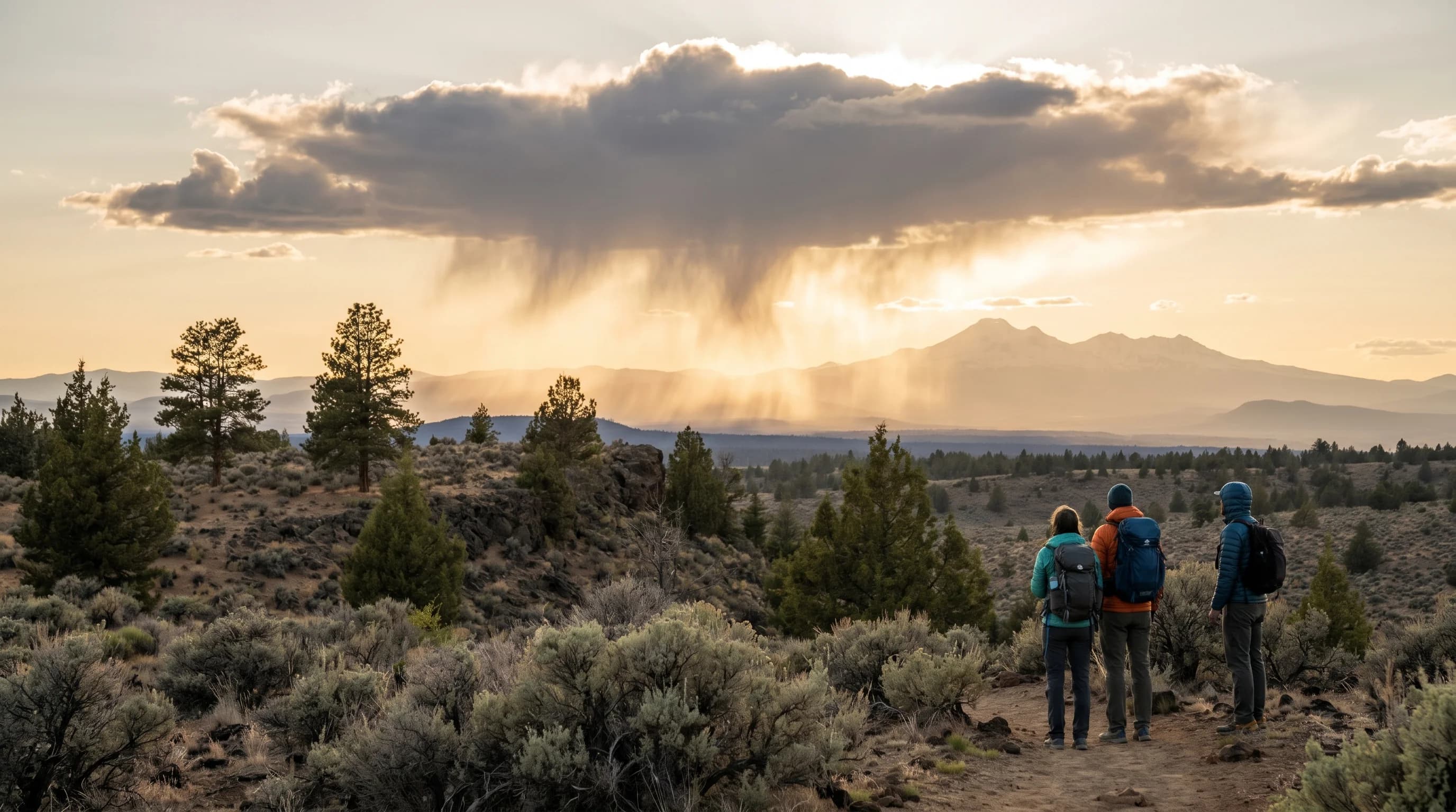
Virga is rain or snow that falls from a cloud but evaporates before it reaches the ground, leaving trailing wisps that hang beneath the cloud and fade into clear air. Those streaks are called fallstreaks, and they are one of the most common sights in dry climates, where the air below the cloud is thirsty enough to swallow the precipitation in mid-fall. If you have ever watched what looks like rain pouring from a cloud over the high desert while the ground below stays bone dry, you have seen virga.
What Is Virga?
The word virga comes from the Latin for a rod or streak, which describes exactly what it looks like: soft, brushed strands hanging down from the base of a cloud, often curving and fraying as they thin out and disappear. It can be made of rain in warm weather or snow in cold weather, and in both cases the defining feature is that the precipitation never completes the trip to the surface. The cloud is clearly producing rain or snow, but a layer of dry air underneath it is intercepting it before it can land.
Virga is most striking near sunrise and sunset, when low-angle light catches the streaks and turns them gold or pink against a darker sky. It is harmless to look at and beautiful to photograph, but as the rest of this article explains, the evaporation that creates it is doing real work in the atmosphere, cooling the air and sometimes driving strong winds toward the ground.
What Causes Virga?
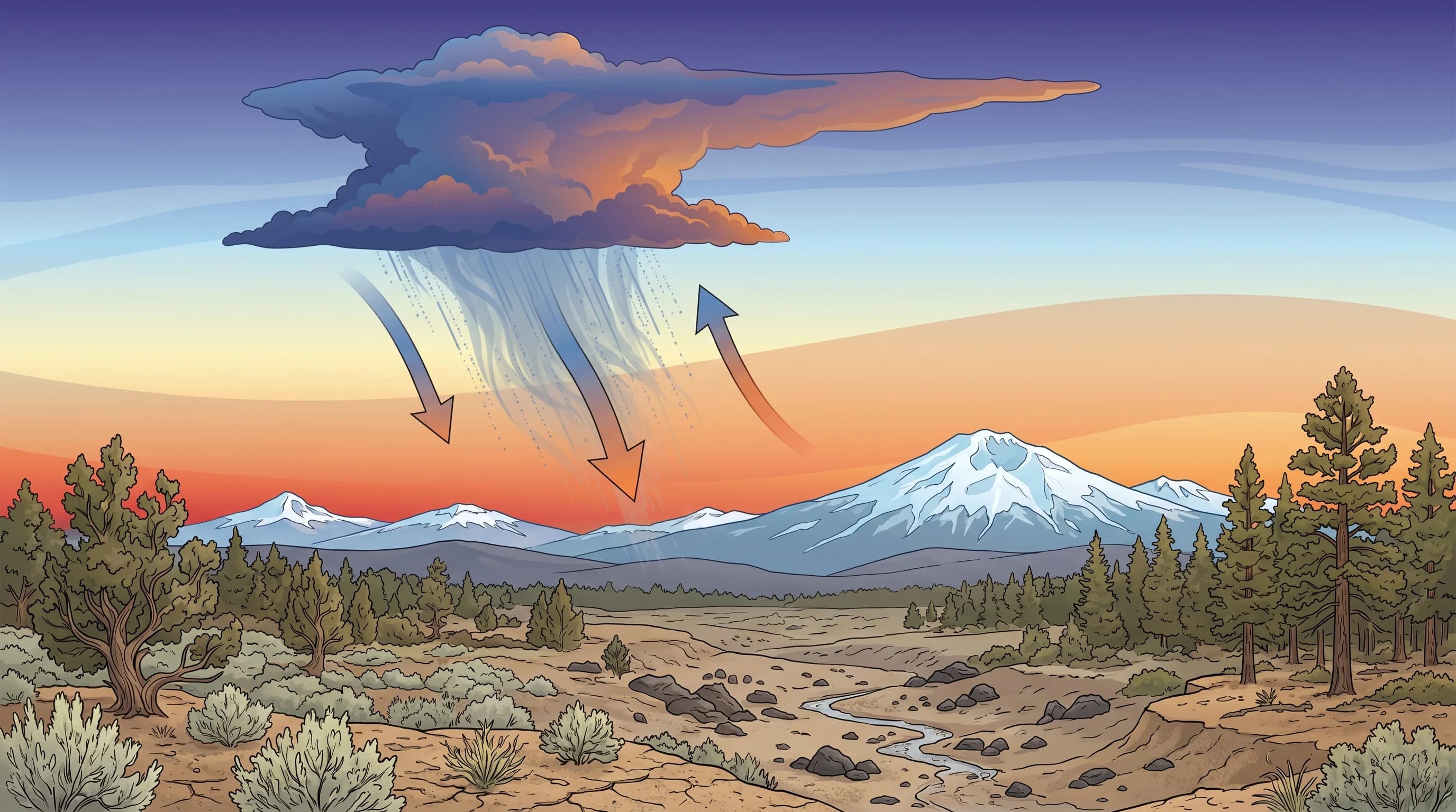
Virga forms when precipitation falls out of a cloud into a layer of dry air below, and that dry air evaporates the raindrops, or sublimates the snowflakes, before they can reach the ground. Evaporation is the key. When liquid water turns to vapor, it absorbs heat from its surroundings, and a drop falling through dry air keeps shrinking as it gives up its mass to the thirsty air. If the dry layer is deep enough, the drop disappears entirely while still high above the surface.
How high the precipitation vanishes depends on how dry the lower air is. In very dry air, rain can evaporate thousands of feet up, leaving long streaks that never come close to the ground. In slightly moister air, the streaks reach lower before fading, and if the air keeps moistening as the rain falls into it, the virga can eventually give way to real rain at the surface. That is why a storm can start as virga and then, once the lower air is saturated, switch over to rain that actually lands.
Snow virga works the same way but through sublimation, the process where ice turns directly to vapor without melting first. Snowflakes falling into very dry, cold air shrink and vanish before reaching the ground, trailing the same hanging streaks you see with rain virga. Because snowflakes are larger and fall more slowly than raindrops, snow virga often appears as especially long, feathery fallstreaks. In both cases, the shape of the streaks also reveals the wind: as the precipitation falls into air moving at a different speed, the streaks bend and curve into the graceful hooks that make virga so distinctive against the sky.
Why Do Dry Climates See So Much Virga?
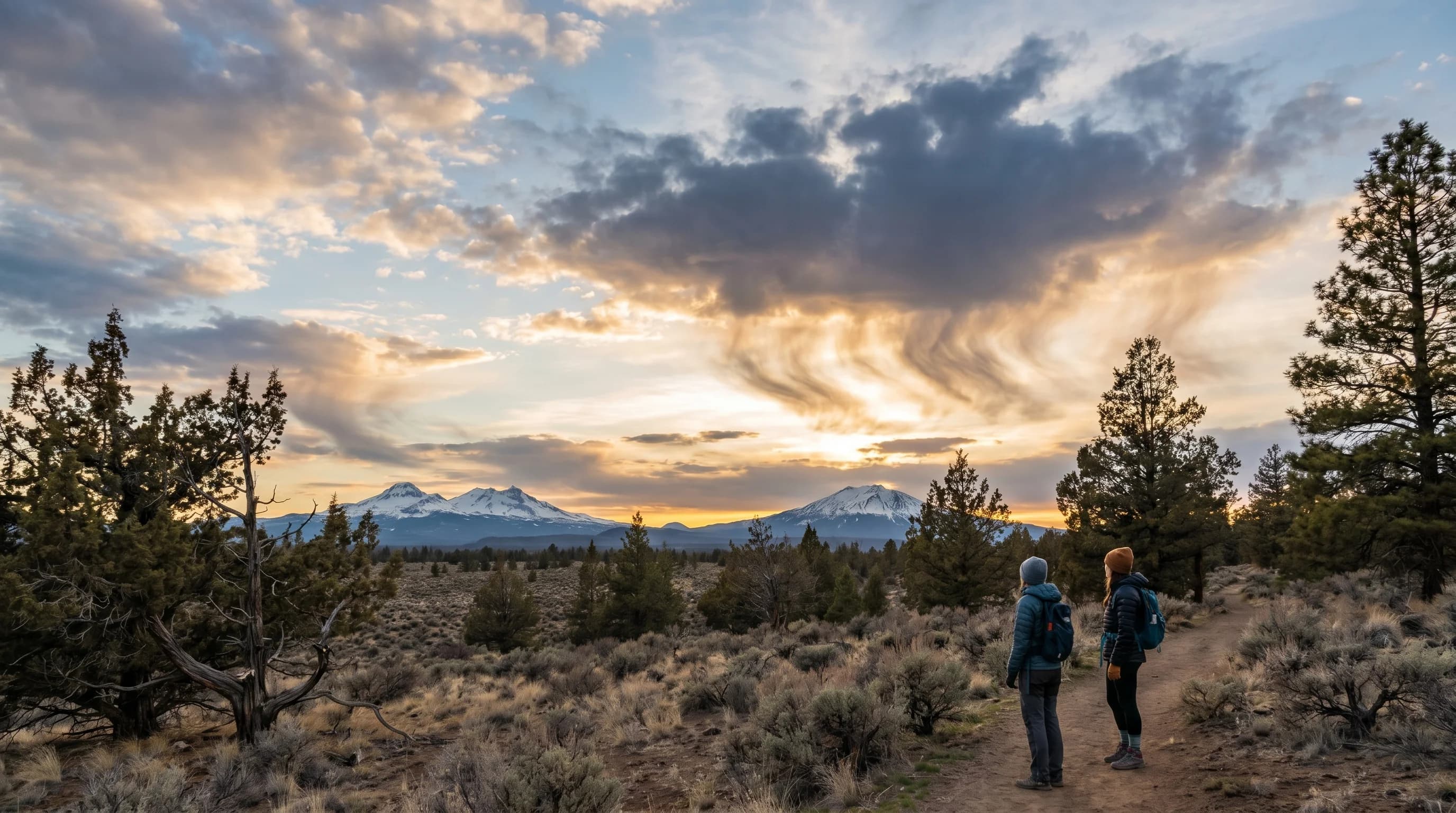
Dry climates see the most virga for the simple reason that their lower atmosphere is arid, which gives falling precipitation the most opportunity to evaporate. A high-desert region like Central Oregon, sitting in the rain shadow east of the Cascades, has exactly this profile: the air near the ground is often very dry even when clouds are building overhead. So it is common to see rain streaming visibly from a cloud over Bend while the streets stay completely dry, the classic high-desert experience of a storm that never arrives.
The same dryness that produces virga is why the region gets so little measurable rain in the first place, a pattern rooted in the Oregon Cascades rain shadow. Virga is, in a sense, the visible signature of that aridity: precipitation trying to fall into air too dry to let it through. The same dry-air story explains why the high desert gets so little rain.
Is Virga Dangerous?
Virga itself is harmless, but the evaporation that creates it can drive genuinely dangerous winds. As precipitation evaporates, it cools the surrounding air, and cool air is denser and heavier than the air around it, so it sinks. In a strong case, that chilled air plunges toward the ground as a powerful downdraft, and when it hits the surface it spreads out violently as a sudden blast of wind. This is the mechanism behind a dry microburst, one of the more hazardous things a desert thunderstorm can produce.
That is why aviation and fire crews pay close attention to virga even though no rain is reaching the ground. A virga shaft can mark the spot where a sudden, severe downburst is about to develop, and the gusty outflow can spread a wildfire or upend small boats and aircraft. The connection between evaporating rain and these sudden wind blasts is explored further in microbursts and in why Central Oregon storms can be dry, windy, and dangerous.
Where Do You See Virga in Central Oregon?
Central Oregon's dry high desert is one of the best places in the country to watch virga, and summer afternoons are prime time. As convective clouds build over the Cascades and the high desert on a hot day, they often produce rain that the dry air below evaporates, trailing dramatic streaks over Bend, Redmond, and the Cascade foothills. The effect is most photogenic at sunset, when the low sun lights the fallstreaks from the side and the whole sky seems to be raining light rather than water.
Virga is not only a summer phenomenon. In winter, snow virga appears when flurries fall from a cloud and sublimate in the dry air before reaching the ground, producing the same hanging streaks in a colder palette. Either way, virga is a reminder of how much the dry high-desert air shapes the weather here: even the rain often does not make it to the ground. Next time you see those streaks fading in the sky over the high desert, you are watching the region's defining dryness at work in real time.