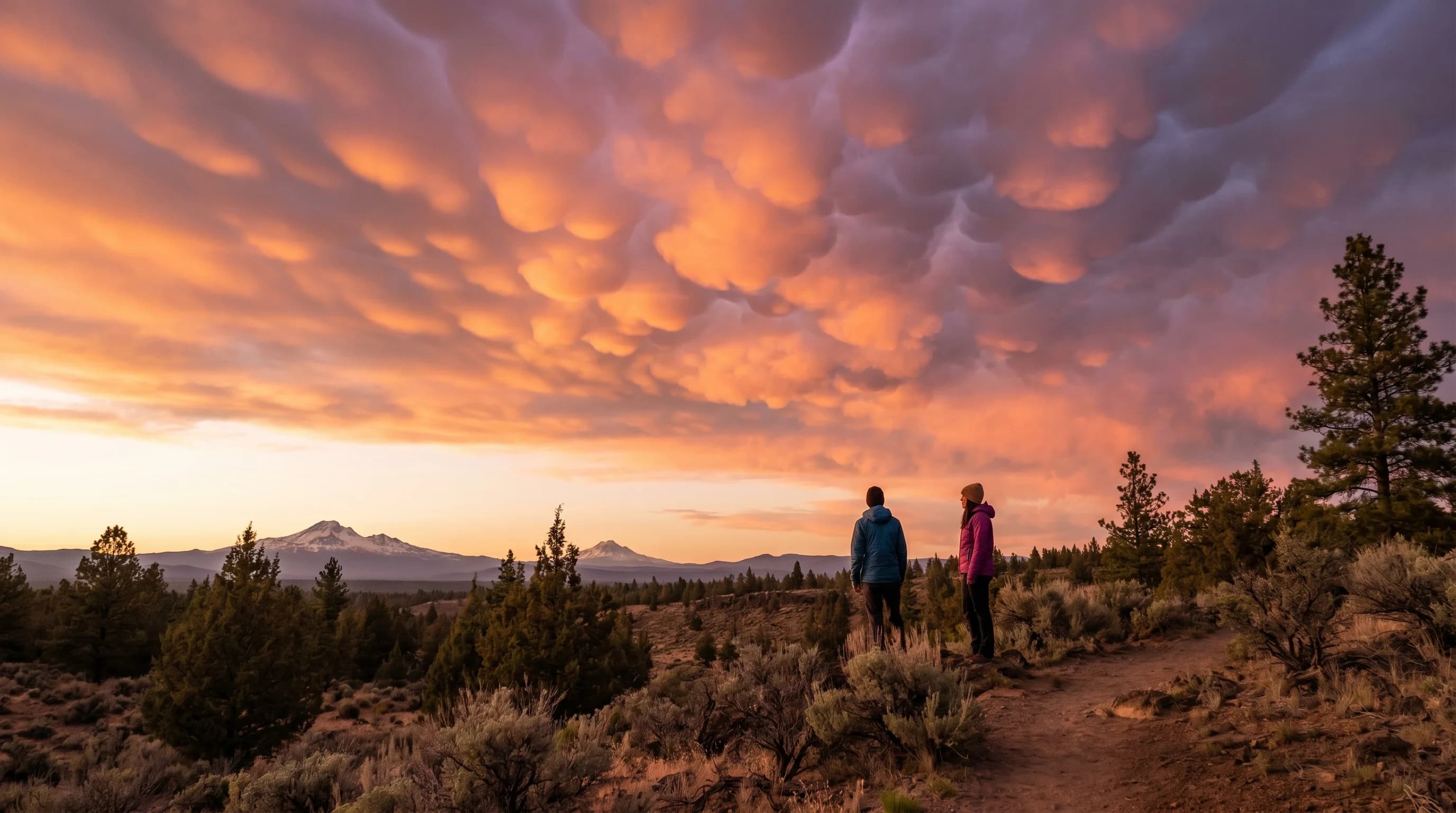
Mammatus clouds are the pouch-like, bubble-shaped lobes that hang down from the underside of a larger cloud, usually the anvil of a thunderstorm. They form in sinking, cooling pockets of air and most often appear as or just after a storm passes, when a sky full of rounded, drooping pouches can look genuinely surreal. Over the Central Oregon high desert they show up during the summer thunderstorm season, frequently lit a dramatic gold or pink by a low sun, and despite their ominous look they are a sign of a storm winding down rather than building.
What Are Mammatus Clouds?
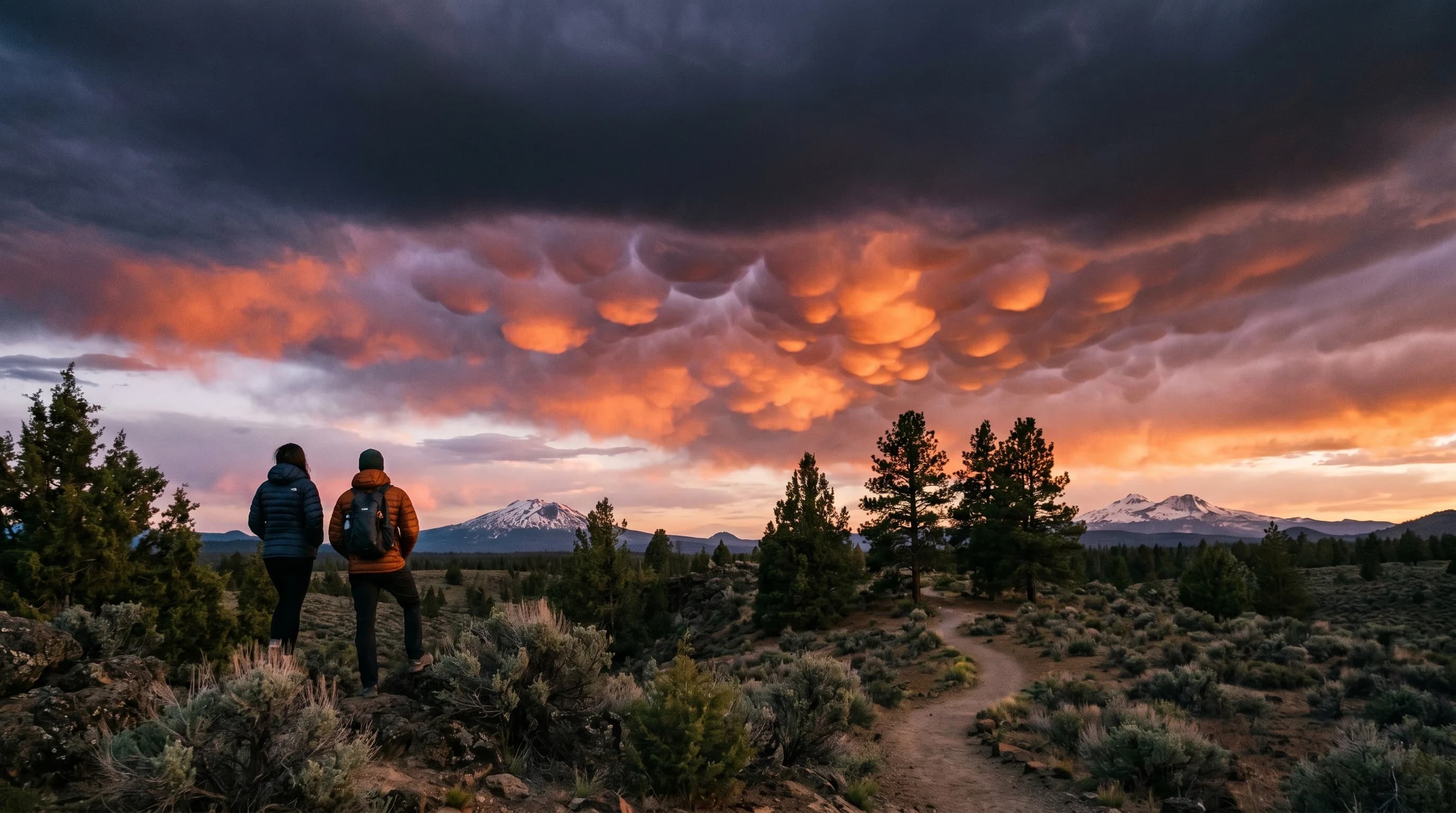
Mammatus clouds are defined by their shape: rows or clusters of smooth, rounded lobes that bulge downward from the base of a cloud, often the spreading anvil of a thunderstorm. The name comes from the Latin for udder, after the rounded, hanging form. They can stretch across a large area of sky in a repeating, honeycomb-like pattern, and their undersides are usually smooth rather than ragged, which gives them an oddly sculpted, three-dimensional appearance.
What makes them so striking is that they bulge downward, the opposite of the upward billows of most puffy clouds. A normal cumulus cloud rises in cauliflower mounds as warm air pushes up into it; mammatus instead sags downward in pouches as cooler air sinks out of the cloud base. That inversion of the usual cloud shape, combined with dramatic lighting when they form near sunset, is why people so often stop and photograph them.
What Causes Mammatus Clouds?
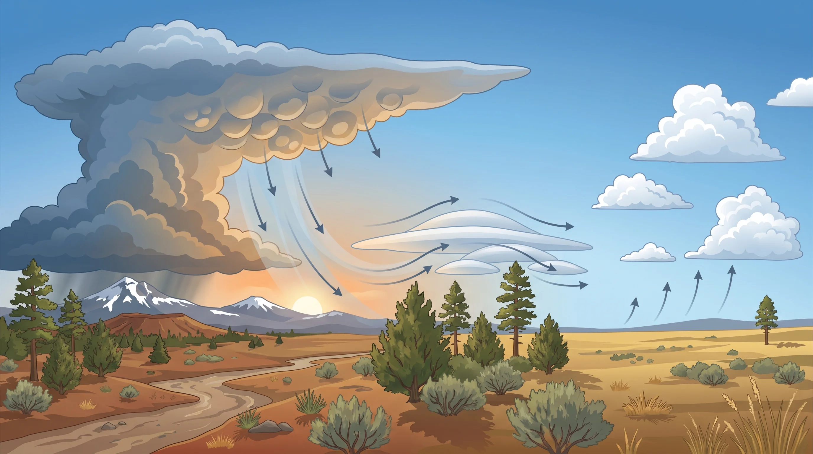
Mammatus clouds form when pockets of cloudy, moisture-laden air sink and cool below the surrounding air, creating the downward-bulging lobes on a cloud's underside. In most clouds, the air is rising; in the spreading anvil of a mature thunderstorm, by contrast, there are regions where saturated, often ice-laden air becomes denser than its surroundings and sinks. As those pockets descend and the cloud material evaporates and cools at their edges, they sag into the rounded pouches we see as mammatus.
Because this happens beneath the anvil of a cumulonimbus, mammatus is closely tied to strong thunderstorms, the kind covered in why Central Oregon gets sudden summer thunderstorms. The lobes mark the parts of the storm's outflow where sinking, cooling air is organized into distinct pockets rather than spread evenly. The exact details of how mammatus forms are still an active area of study, but the basic picture, sinking moist pockets sagging below the cloud, captures the essential mechanism and explains the upside-down look.
The pouches are also relatively short-lived, which is part of their appeal. A mammatus display often lasts only ten or fifteen minutes before the lobes smooth out and the cloud dissipates, because the sinking pockets that create them are a transient feature of the storm's outflow rather than a stable structure. That is why catching a good mammatus sky feels like timing: the storm has to be in the right phase, the sun in the right place, and you have to be looking up at the right moment. Each lobe is essentially a snapshot of a parcel of cloudy air caught mid-descent.
Are Mammatus Clouds Dangerous? Do They Mean a Tornado?
Mammatus clouds are not dangerous themselves and do not mean a tornado, but they do show that a powerful thunderstorm is nearby, so the storm itself can be hazardous. They most often appear after the most intense part of a storm has passed, on the trailing edge of the anvil, which is why seeing them frequently means the worst of the weather is moving away rather than approaching. They are an effect of a strong storm, not a cause or a warning of one.
The confusion with tornadoes comes from how ominous a sky full of dark, drooping pouches looks, but the two are unrelated phenomena. A tornado forms from rotating updrafts in the storm; mammatus forms from sinking pockets in the anvil. If you want the real green-sky tornado question, that belongs to a different storm signal, covered in why the sky turns green before a storm. With mammatus, treat the parent thunderstorm, especially its lightning, as the hazard, not the clouds themselves.
When Do Mammatus Clouds Appear Over Central Oregon?
Mammatus clouds appear over Central Oregon during the summer thunderstorm season, most often late in the day as high-desert storms mature and wind down. The wide-open skies of the high desert give sweeping, unobstructed views of the lobed underside of a storm anvil, and the dry, clear air around the storm often lets a low sun light the pouches from beneath. The combination of a big anvil overhead and golden evening light produces the region's most photogenic mammatus displays.
They are most likely from June through early fall, the same window when afternoon thunderstorms build over the Cascades and drift across the high desert. Spotting mammatus is a good cue that a strong storm has been at work nearby, and a reminder to keep an eye on the parent storm's lightning and wind even as the dramatic clouds signal that the worst is passing.
How Are Mammatus Clouds Different From Other Dramatic Clouds?
Mammatus clouds are unique for bulging downward in rounded pouches, which sets them apart from the other dramatic clouds of the region. A lenticular cloud is a smooth lens or saucer that hangs over a mountain in a standing wave, a completely different shape born of a completely different process. A green storm sky is a color, not a shape, caused by light scattering through a deep hail-filled storm.
Each of these is a window into a different part of the atmosphere: mammatus into the sinking pockets beneath a storm anvil, lenticulars into the standing waves of air over the mountains, and a green sky into the depths of a hail-laden thunderstorm. Learning to tell them apart turns a dramatic sky from something merely impressive into something readable, a set of clues about what the weather is actually doing. Of the three, mammatus is the one that says a powerful storm has just been overhead.