Lenticular clouds are the smooth, lens-shaped or saucer-shaped clouds that form over and downwind of mountains when moist air flows across the peaks and rises into a standing wave. Their clean, layered, almost machined shape is why people so often mistake them for UFOs. They form when stable, moist air is lifted over a summit and condenses at the crest of the resulting wave, and over the Oregon Cascades they stack above Mt. Bachelor, the Three Sisters, and Mt. Hood with remarkable regularity, making them one of the most distinctive sights in Central Oregon's sky.
What Are Lenticular Clouds?
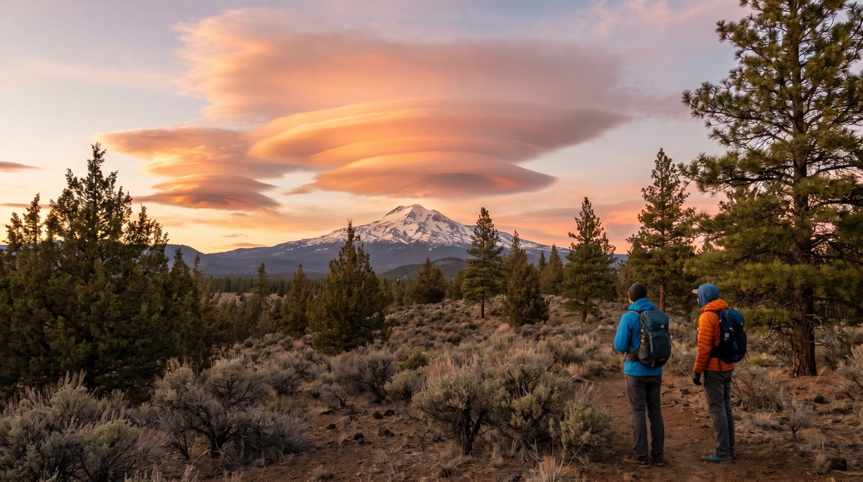
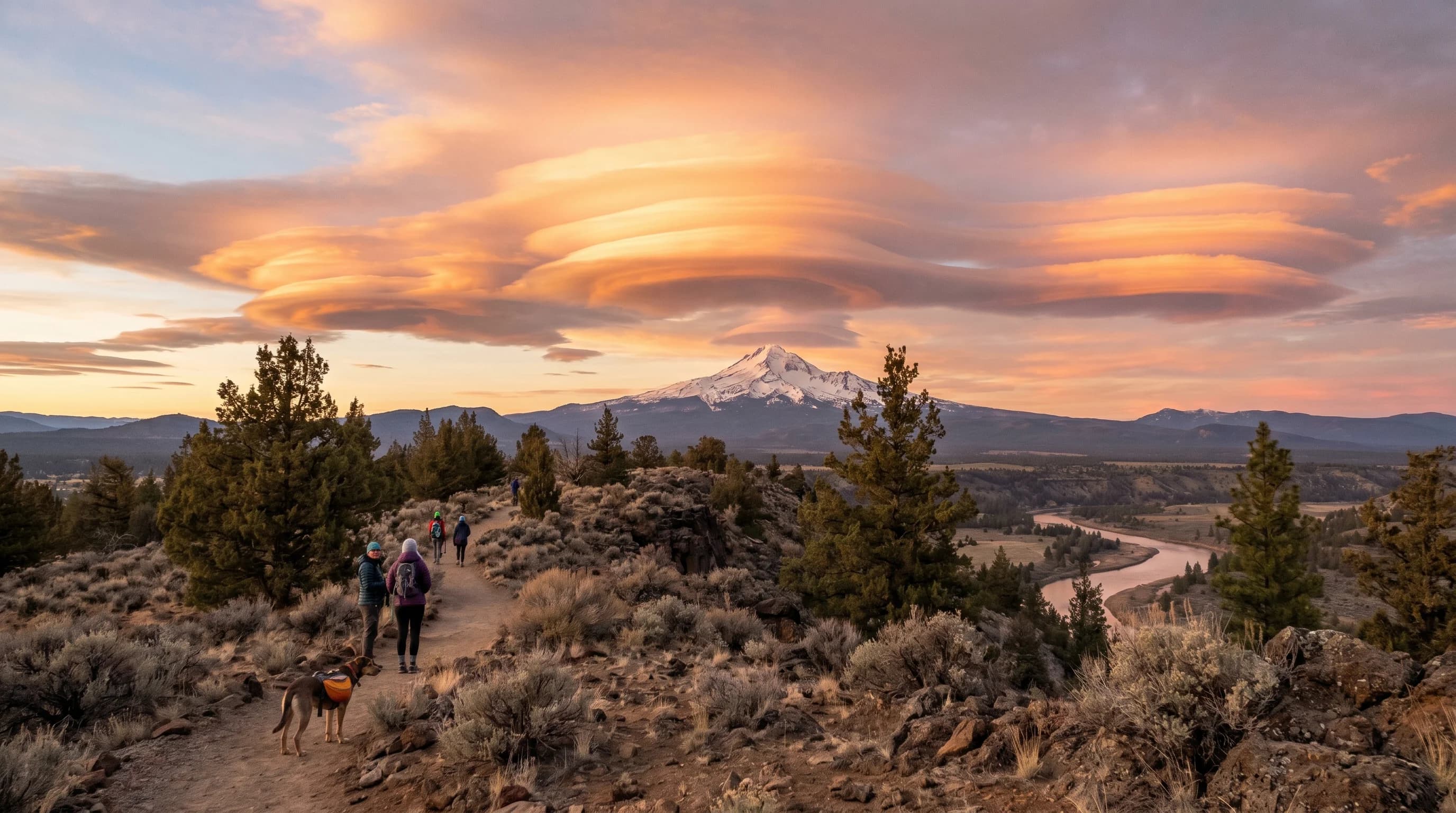
Lenticular clouds, known formally as altocumulus lenticularis, are defined by their smooth, rounded, lens-like shape, often with sharp, clean edges that set them apart from the ragged puffs of ordinary cumulus. They can appear as a single saucer hanging over a peak or as a stack of layered discs piled up like a pile of plates, a form sometimes called a pile d'assiettes. At sunrise and sunset they can light up in vivid oranges and pinks, which only adds to their otherworldly look.
The most striking thing about them is that they appear to hang motionless, even in a strong wind. A lenticular cloud can sit in essentially the same spot in the sky for hours while the air is rushing through it at high speed, which is the opposite of how most clouds behave. That stillness, combined with the smooth saucer shape, is exactly what gives them their UFO reputation, and it is a direct clue to how they form.
How Do Lenticular Clouds Form?
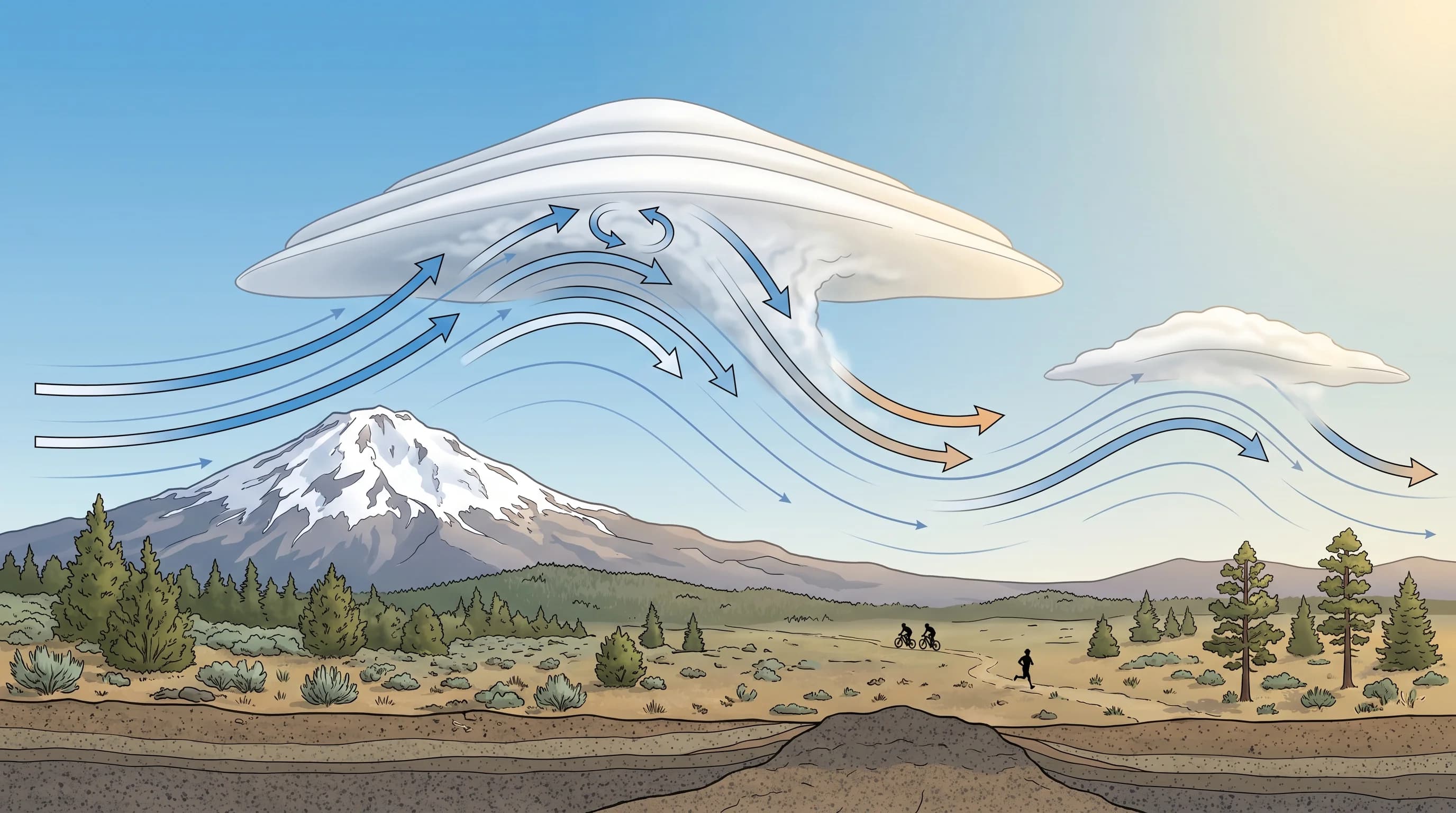
Lenticular clouds form when stable, moist air is pushed up and over a mountain, creating a wave in the airflow on the downwind side, much like water flowing over a submerged rock creates a standing wave on the surface of a river. As the air rises toward the crest of that wave, it cools, and if it cools enough to reach saturation, its moisture condenses into a cloud at the top of the wave. As the same air descends into the trough beyond, it warms and the cloud evaporates. The cloud forms on the upwind side and dissolves on the downwind side continuously.
That continuous forming-and-dissolving is the secret to why they seem to stand still. The cloud is not a blob of air being carried along by the wind; it is a marker of a fixed location in the atmosphere where rising air is condensing. Air streams through the cloud, condensing as it enters the wave crest and evaporating as it leaves, so the cloud holds its position even as the wind howls through it. Stable air is essential, because it is what allows the air to oscillate in a smooth wave rather than billowing up into turbulent cumulus. Stacked lenticulars form when several moist layers each condense at their own level in the wave.
Why Do Lenticular Clouds Look Like They Are Standing Still?
Lenticular clouds appear to stand still because they continuously form on the upwind side of a standing wave and evaporate on the downwind side, holding their position even as wind rushes through them. The cloud is a feature of the airflow, not a parcel of air, so it stays put over the same spot relative to the mountain that created the wave. This is why you can watch one for an hour and see it barely move while flags and treetops below it are whipping in strong wind.
That behavior makes lenticulars a reliable visual sign of two things: strong wind aloft and stable, layered air. Pilots treat them as a clear warning of powerful mountain-wave winds and the turbulence that often surrounds them, even though the clouds themselves are smooth. For someone on the ground, a lenticular stacking up over a Cascade peak is a sign that the upper atmosphere is moving fast and that a change in the weather may not be far behind.
Where Do You See Lenticular Clouds in the Cascades?
The Oregon Cascades are one of the best places in the country to see lenticular clouds, because the tall, isolated volcanic peaks are ideal wave-makers for the moist Pacific air flowing over them. Lens clouds regularly stack over Mt. Bachelor, the Three Sisters, Broken Top, and Mt. Hood, and from the open high desert around Bend and Sisters you get a clear, wide view of the whole peak line at once. The same orographic lift that drives the Cascade rain shadow is what sets up the standing waves that build these clouds.
They are most spectacular at sunrise and sunset, when low-angle light underlights the smooth layers and turns them gold and pink against a darkening sky. They can appear in any season but are especially common when strong, moist flow crosses the range ahead of an incoming system. For anyone watching Central Oregon's mountains, a lenticular is the sky's way of showing the invisible wave of air rolling over the peaks. The operational weather of the region's main peak is covered in the Mt. Bachelor weather guide.
Do Lenticular Clouds Mean a Storm Is Coming?
Lenticular clouds signal strong wind aloft and increasing moisture, which often, though not always, means a weather change is on the way. They frequently appear ahead of an incoming Pacific system, as the strengthening flow and rising moisture that precede a front are exactly the conditions that build mountain waves. So a sky filling with stacked lenticulars over the Cascades is a reasonable hint that wind and possibly precipitation are coming over the next day or two.
On their own, though, lenticulars mean wind and stable layered air more than they guarantee rain or snow. Plenty form during dry, windy spells that never bring a storm. They are best read as a sign that the upper atmosphere is active rather than as a firm forecast. Either way, they are one of the great free shows of the high-desert sky, a reminder that the air flowing over the Cascades has a hidden structure of waves you can sometimes see made visible in cloud.