Orographic lift is what happens when moving air runs into a mountain and is forced to rise up and over it. As that air climbs, it cools, its moisture condenses into clouds, and it drops rain or snow on the upwind side, then descends warm and dry down the other side. It is one of the most important processes in mountain weather, and it explains a pattern visible all over the West: lush, wet slopes on one side of a range and dry country, even desert, just behind it. In Oregon, orographic lift over the Cascades is the single biggest reason the western valleys are green and Central Oregon is high desert.
What Is Orographic Lift?
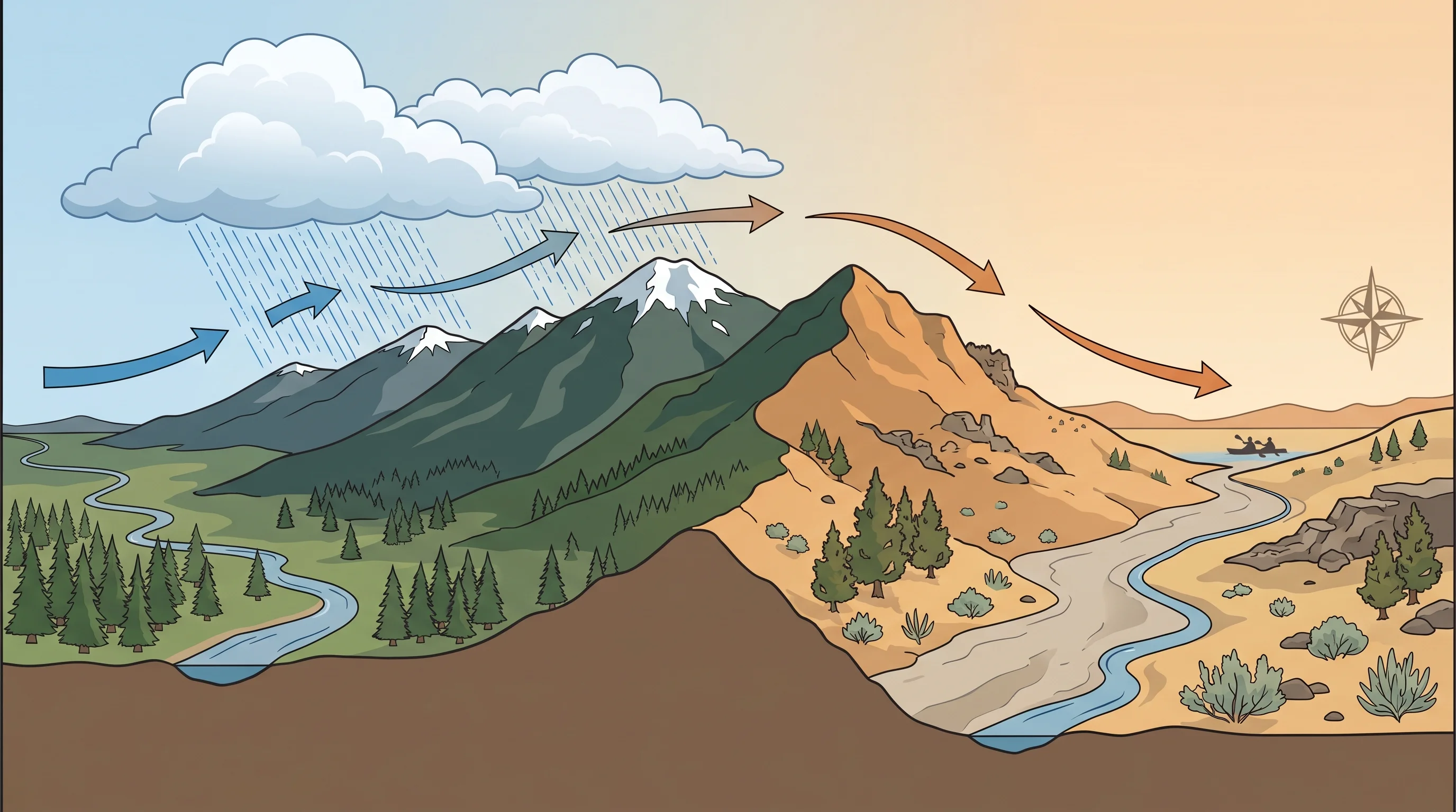
The word orographic simply means relating to mountains, so orographic lift is the lifting of air by terrain. When wind carrying moisture meets a mountain range, the air cannot go through the rock, so it is pushed upward along the slope. This forced ascent is the engine behind a huge share of the rain and snow that falls in mountainous regions, and it is the reason precipitation totals can vary enormously over short distances, with one side of a ridge soaked and the other side parched.
Orographic lift is different from the lifting that drives thunderstorms, where the sun heats the ground and warm air rises on its own. Here the lifting is mechanical: the terrain itself shoves the air upward whether it wants to rise or not. That makes orographic precipitation reliable and persistent. As long as moist wind keeps flowing against the mountains, the slopes keep wringing out moisture, which is why mountain ranges build deep, dependable snowpacks winter after winter.
How Does Orographic Lift Make Rain?
The rain comes from cooling. As air rises, it expands in the lower pressure aloft, and expanding air cools, a process called adiabatic cooling that happens at a predictable rate of a few degrees per thousand feet. Cooler air cannot hold as much water vapor, so as the rising air chills, its moisture reaches saturation, condenses into cloud droplets, and eventually falls as rain or snow. The taller and steeper the range, and the moister the incoming air, the more precipitation it squeezes out.
This is why the heaviest precipitation falls on the windward slopes and crest of a range rather than at its base. The air has done most of its climbing and cooling by the time it reaches the high country, so that is where the clouds dump their load. In the Oregon Cascades, the western slopes and the crest can collect well over a hundred inches of precipitation a year, much of it as the deep mountain snow that feeds the region's rivers through the dry season.
Whether that precipitation falls as rain or snow depends on how cold the rising air gets, which is mostly a matter of elevation and season. Lower windward slopes often get rain while the high crest gets snow from the very same storm, and the dividing line, the snow level, can shift hundreds of feet up or down during a single event. Some moisture also spills past the crest before it fully rains out, which is why the zone just east of the Cascades still gets meaningful snow even as the totals drop off sharply farther into the high desert. This interaction of lift, cooling, and elevation is what makes snow level the make-or-break number in a Central Oregon winter forecast.
What Is a Rain Shadow?
A rain shadow is the dry zone on the downwind, or leeward, side of a mountain range, and it is the direct consequence of orographic lift. By the time air crests the range, it has already lost most of its moisture climbing the windward side. As it descends the far slope, it does the opposite of what it did going up: it compresses and warms, which lowers its relative humidity and actively discourages clouds from forming. The leeward side ends up dry, sunny, and often much warmer than the wet windward side at the same elevation.
Rain shadows are why deserts so often sit just east of major ranges across the American West. Central Oregon is a clear example: it lies directly in the lee of the Cascades and receives only a fraction of the precipitation that falls on the western side. The full local picture, including how dramatic the contrast is, is laid out in the Oregon Cascades rain shadow, which is the reason Bend gets so little rain.
What Is the Difference Between Windward and Leeward?
Windward and leeward are the two sides of the mountain in this story. The windward side faces the incoming wind and takes the brunt of the rising, cooling, raining air, so it stays wet and green. The leeward side is sheltered behind the crest, in the rain shadow, where the descending air is dry and warm. The same range can therefore host two completely different climates within a few miles, separated only by the ridgeline.
Oregon makes the contrast vivid. Windward, west-side Oregon, the coast and the Willamette Valley, is famously wet and gray, while leeward Central Oregon is dry, sunny high desert. The mountains in between are doing all the work, lifting and wringing out the air on the way up and drying it on the way down. The same airflow over the peaks also produces the smooth, stacked lenticular clouds that form in the waves of air crossing the Cascades.
Where Do You See Orographic Lift in Oregon?
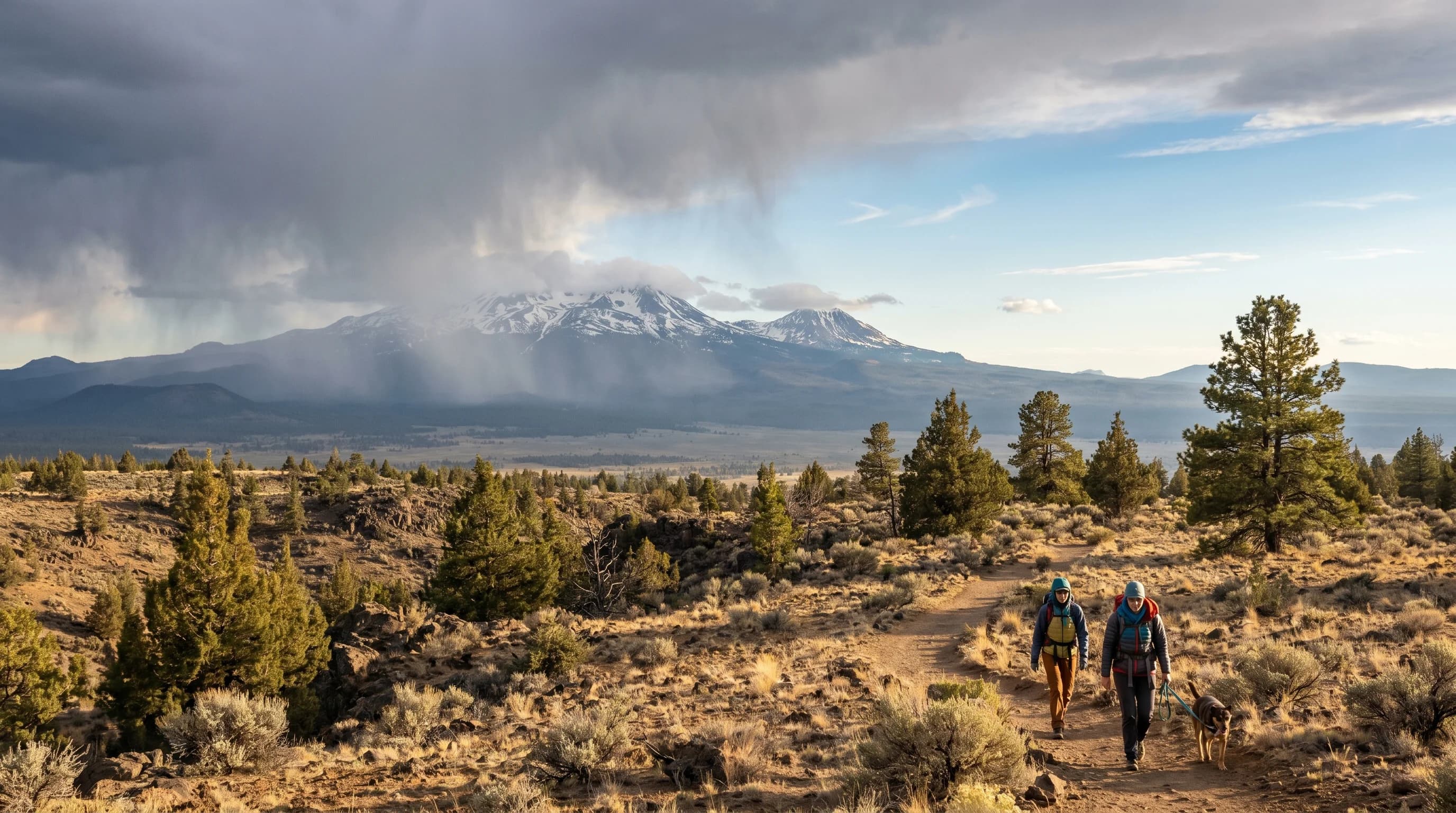
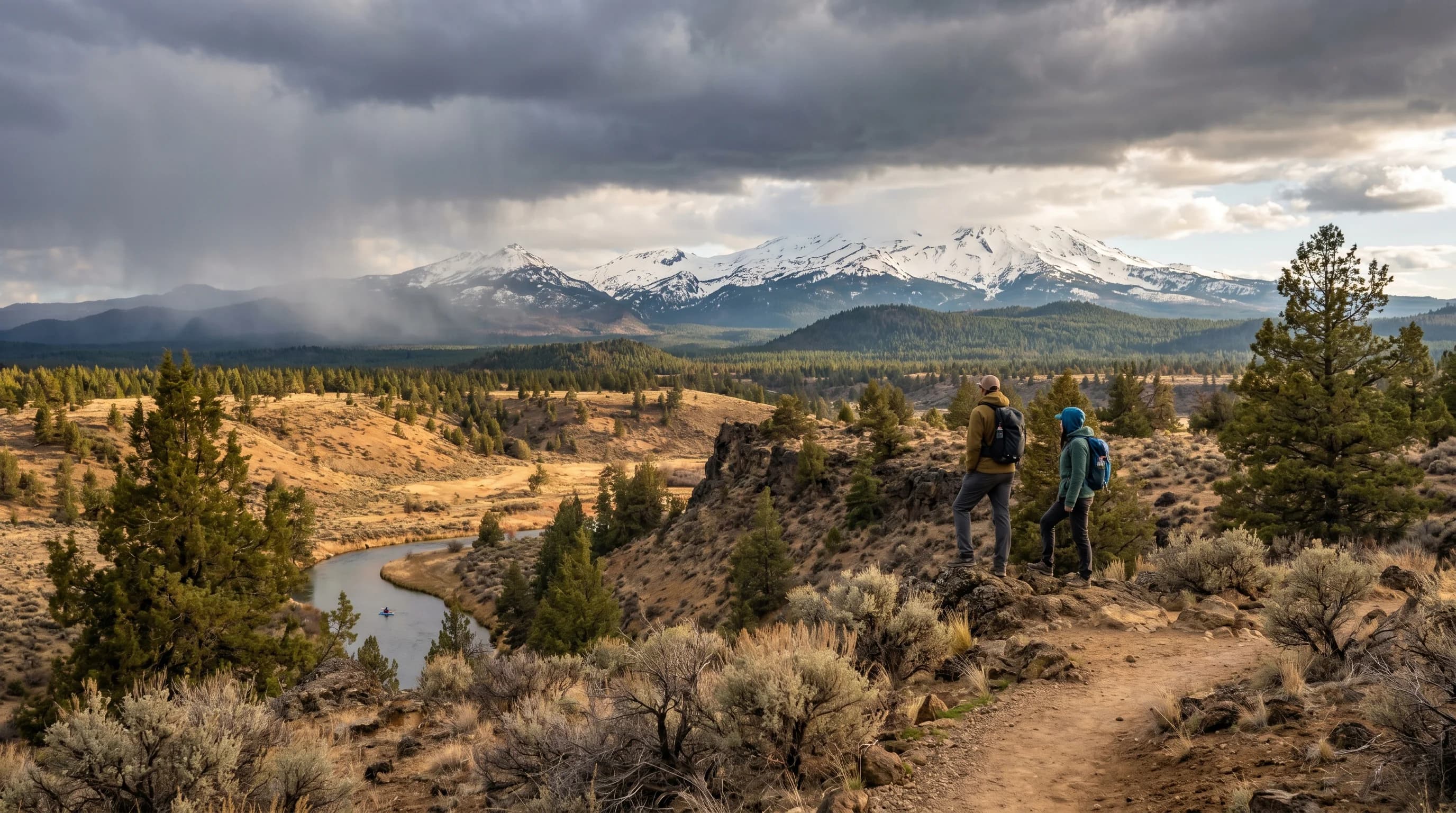
The Oregon Cascades are a textbook case of orographic lift, and you can read the whole process across the state from west to east. Pacific storms arrive on the coast, rise over the Coast Range and then the much higher Cascades, and pile up rain and snow on the western slopes and crest. Mt. Bachelor and the Three Sisters collect enormous snowfall on their windward sides, while Bend, just to the east, sits in the dry shadow and gets a small fraction of it.
That single mechanism shapes nearly everything about Central Oregon weather: the low rainfall, the abundant sun, the deep mountain snowpack that supplies summer water, and even the big day-to-night temperature swings that come with dry, clear air. Once you can picture air being forced up the mountains, raining itself out, and descending dry into the high desert, the region's whole climate clicks into place. It is also why a storm can bury the Cascades while leaving the towns barely damp, the everyday reality behind why it can rain in Bend but snow at Mt. Bachelor.