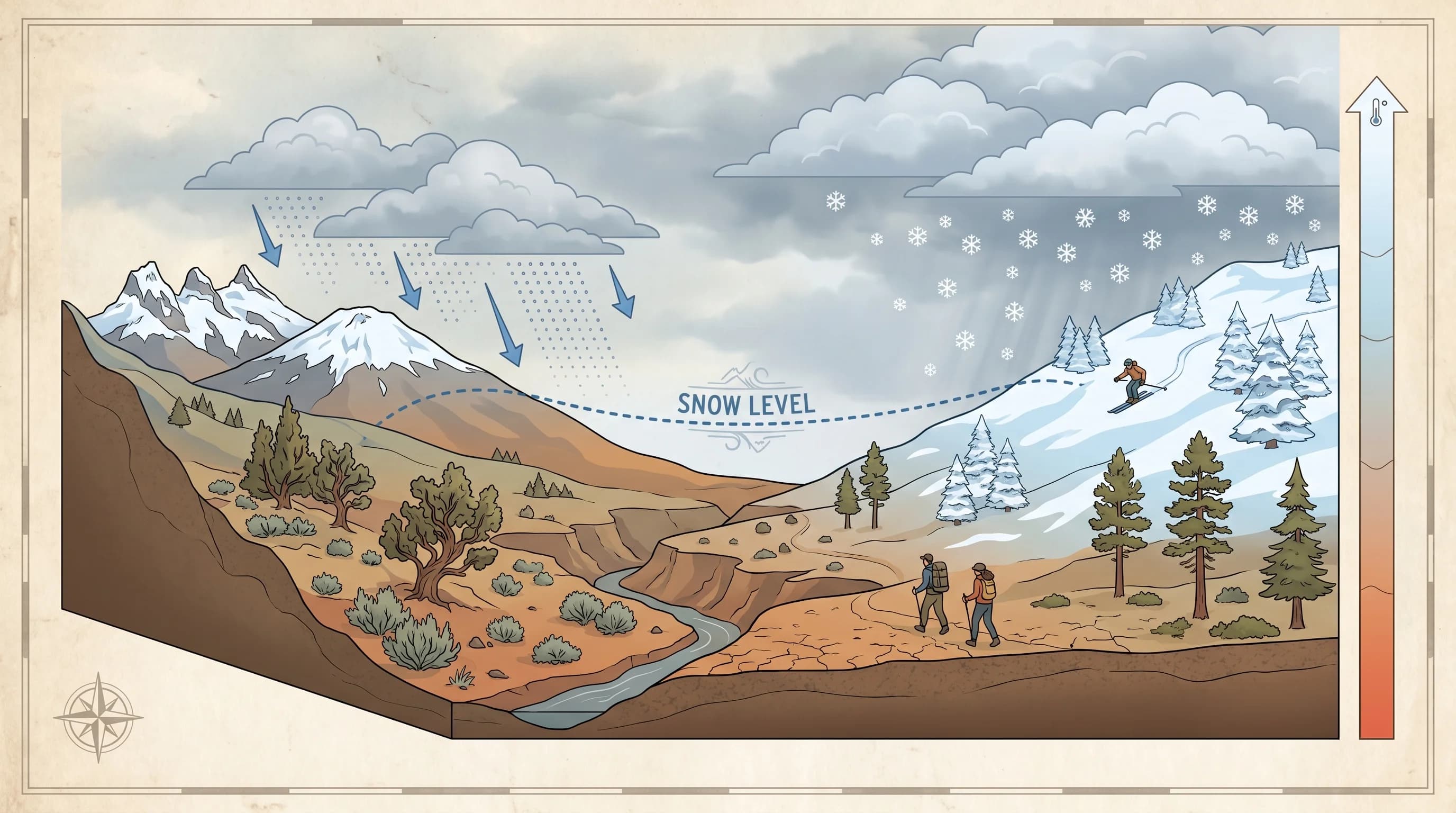
The snow level is the elevation at which falling precipitation changes from rain to snow. Below that elevation it rains; above it, it snows. In Central Oregon, where the land climbs from about 2,700 feet on the eastern plains to over 9,000 feet at the Cascade crest, the snow level is the single most useful number in a winter forecast, because it decides whether Bend stays wet while the mountains get buried. Learning to read an Oregon snow level map or forecast against your own elevation is the key to knowing what you will actually drive and play in.
What Is the Snow Level?
The snow level is exactly what it sounds like: the height above sea level where precipitation falling from a storm transitions from rain to snow. You can sometimes see it directly on a hillside as a clean line, with bare, wet ground below and white snow above. Forecasters give it as an elevation in feet, and it is one of the most practical pieces of a Central Oregon winter forecast because it translates a storm into what will actually happen at any given place.
It is worth distinguishing the snow level from the freezing level. The freezing level is the height where the air temperature hits 32 degrees, and the snow level usually sits a bit below it, because snow takes time to melt as it falls into the warmer air beneath the freezing level. The snow level is the more useful, on-the-ground number for travel and recreation, and it can rise and fall by hundreds of feet during a single storm as the air mass changes.
How Do You Read an Oregon Snow Level Forecast?
You read a snow level forecast by comparing the forecast snow level to your elevation: if the number is below where you are, expect snow; if it is above you, expect rain; and if it is right at your elevation, expect a messy rain-snow mix. So the first thing to know is the elevation of the places you care about, your home, your route, and your destination, and then to watch the forecast snow level against them through the storm.
The wrinkle is that the snow level moves. Many storms start warmer, with a high snow level, and then cool as colder air arrives, dropping the snow level and switching rain over to snow, sometimes overnight when temperatures fall. Watching the trend, rising or falling, is as important as the single number, especially for timing a drive over a pass or catching a powder day. This is the same dynamic behind why it can rain in Bend but snow at Mt. Bachelor.
A quick worked example makes it concrete. Say the forecast snow level is 4,000 feet. Redmond at roughly 3,000 feet is well below that, so it gets rain; Bend at about 3,600 feet is still below it, so cold rain or a rain-snow mix; Sunriver at around 4,150 feet is just above it, so wet snow; and Mt. Bachelor's base at 6,300 feet is far above it, so all snow. Now drop the forecast snow level to 3,000 feet, and suddenly the whole region is in snow, including Redmond. That is the entire winter forecast in one number, which is why locals learn to listen for it first.
Why Does Snow Level Matter So Much in Central Oregon?
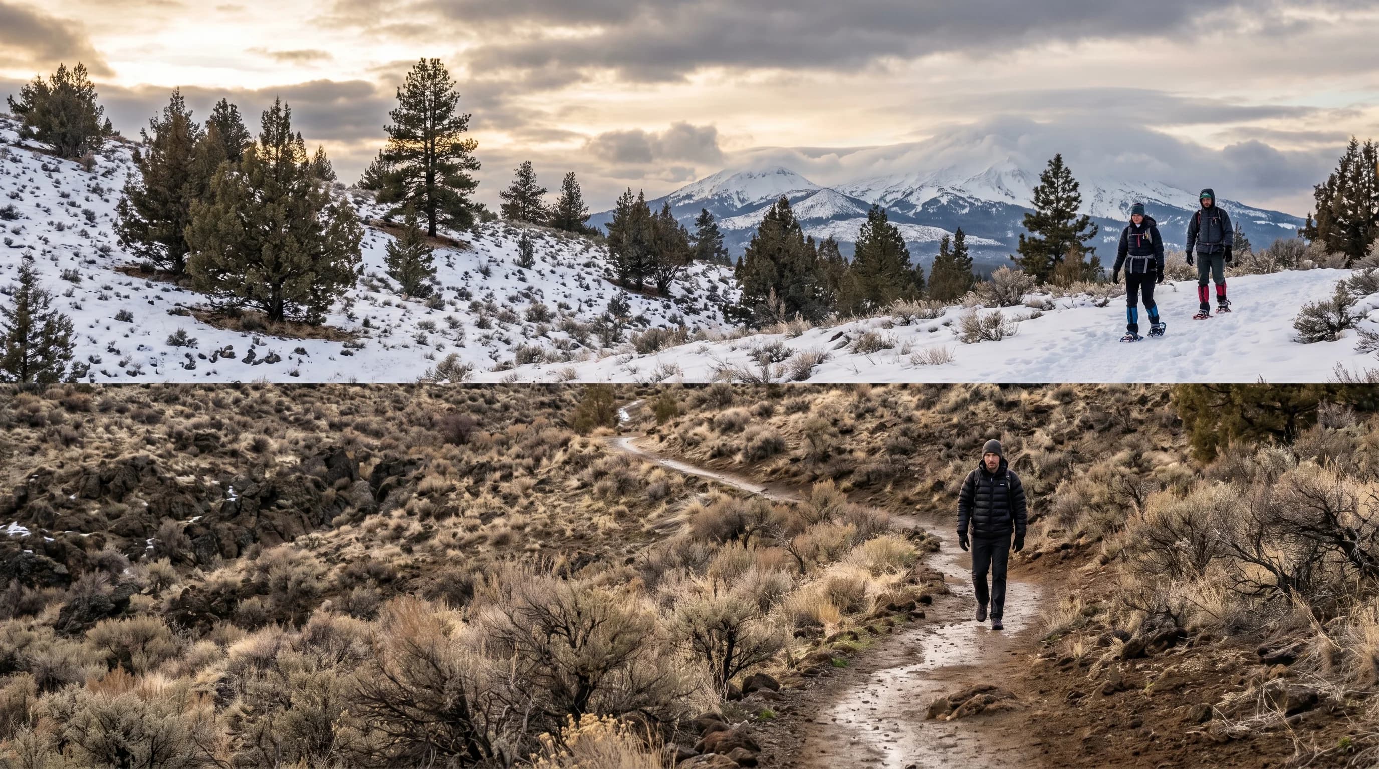
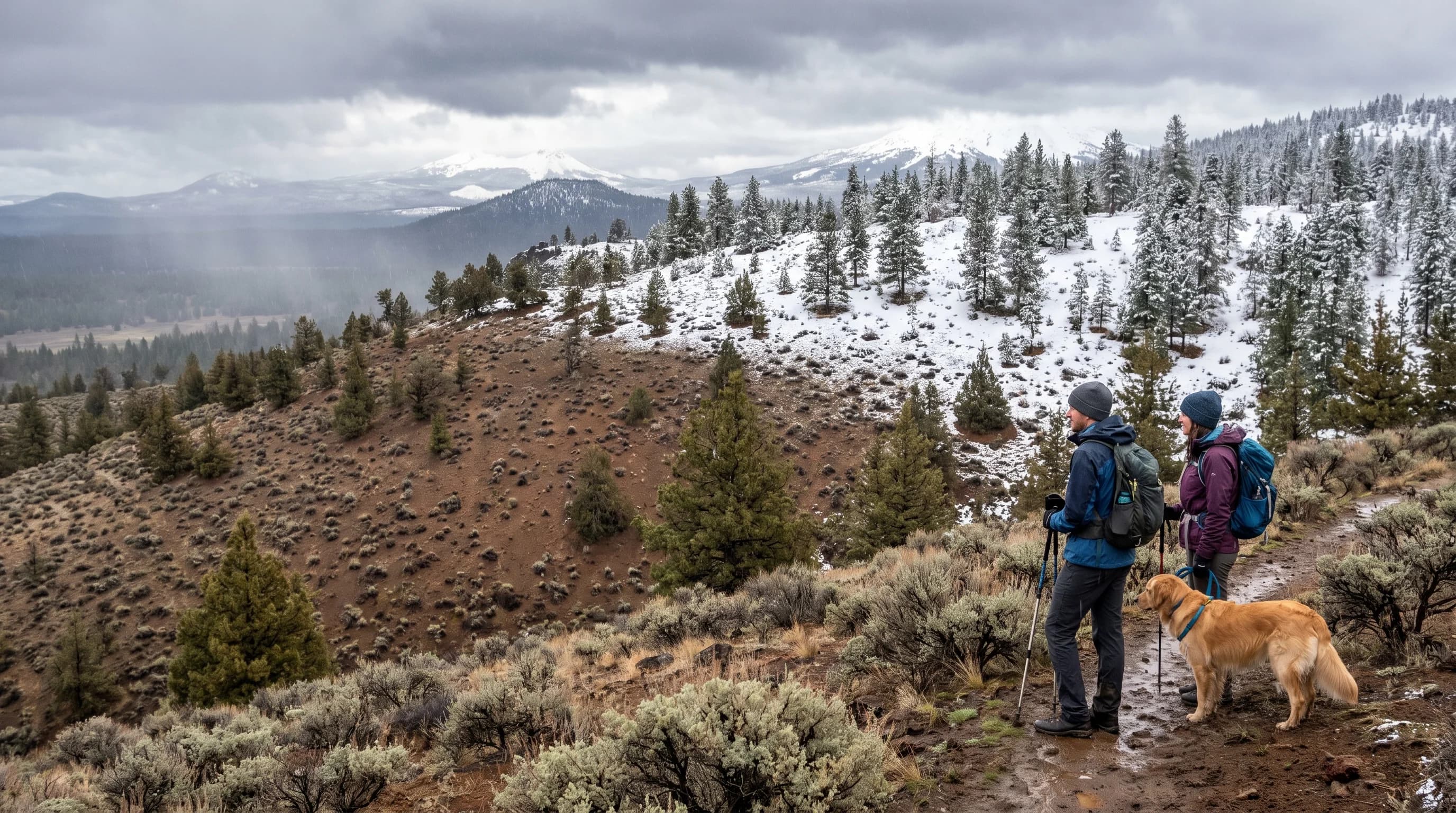
Snow level matters enormously in Central Oregon because the region spans such a big elevation range that a single storm can rain in Redmond, snow in Bend, and bury Mt. Bachelor, all at the same time. Redmond sits around 3,000 feet, Bend near 3,600, Sunriver higher, and the Cascade trailheads and ski areas higher still, so a snow level of, say, 3,500 feet draws the rain-snow line right through the middle of where people live.
Bend's position near that common snow-level band is exactly why its winters are so variable: a shift of a few hundred feet decides whether a storm brings snow, slush, or cold rain to town. For drivers, the snow level is the number that tells you whether a pass will be snowy and whether you need chains or just wipers, and for skiers it tells you whether fresh snow will reach the base or only the upper mountain.
Snow Level on the Cascade Passes
The Cascade passes sit high enough that they often get snow even when the towns get rain, so snow level is the key number for safe pass travel. Santiam Pass and the high points of the Cascade Lakes Highway are well above the towns, so a snow level that means cold rain in Bend can mean accumulating snow and ice on the pass. A rising snow level during a storm can turn a pass from snow to slush to refrozen ice, each with its own hazard.
For anyone driving between Central Oregon and the valley in winter, checking the snow level against the pass elevation is essential, and it pairs with the ice hazards covered in black ice and the sudden whiteouts of a snow squall. The pass can be a completely different world from the town at the bottom of the grade, and the snow level is what tells you so before you start up.
What Is the Difference Between Snow Level and Freezing Level?
The freezing level is where the air hits 32 degrees, and the snow level usually sits a bit below it because snow needs time to melt as it falls into warmer air beneath that height. In heavy precipitation, the cooling effect of all that melting snow can actually drag the snow level down, so a hard, steady snowfall sometimes lowers the snow level as it goes, bringing snow to elevations that started out as rain.
For practical purposes, the snow level is the number to watch, since it tells you what is reaching the ground rather than what is happening up in the air. Pair it with the broader regional picture in the Central Oregon snow guide, and you have the core tools for reading a high-desert winter: know your elevation, watch the snow level and its trend, and treat the passes as their own, higher, snowier world.