The polar vortex is a ring of strong west winds that circles the Arctic every winter, far above the weather. It stays over the far north and never reaches Oregon itself. The bitter Arctic air that news stories blame on it does reach Central Oregon a few times a decade. When it arrives, Bend and Redmond can drop well below zero.
Central Oregon takes these cold snaps harder than western Oregon because the Cascades hold the cold air on the east side. Redmond's records also show that its worst cold snaps since 1958 did not follow the polar vortex breakdowns that make national news.
What Is the Polar Vortex?
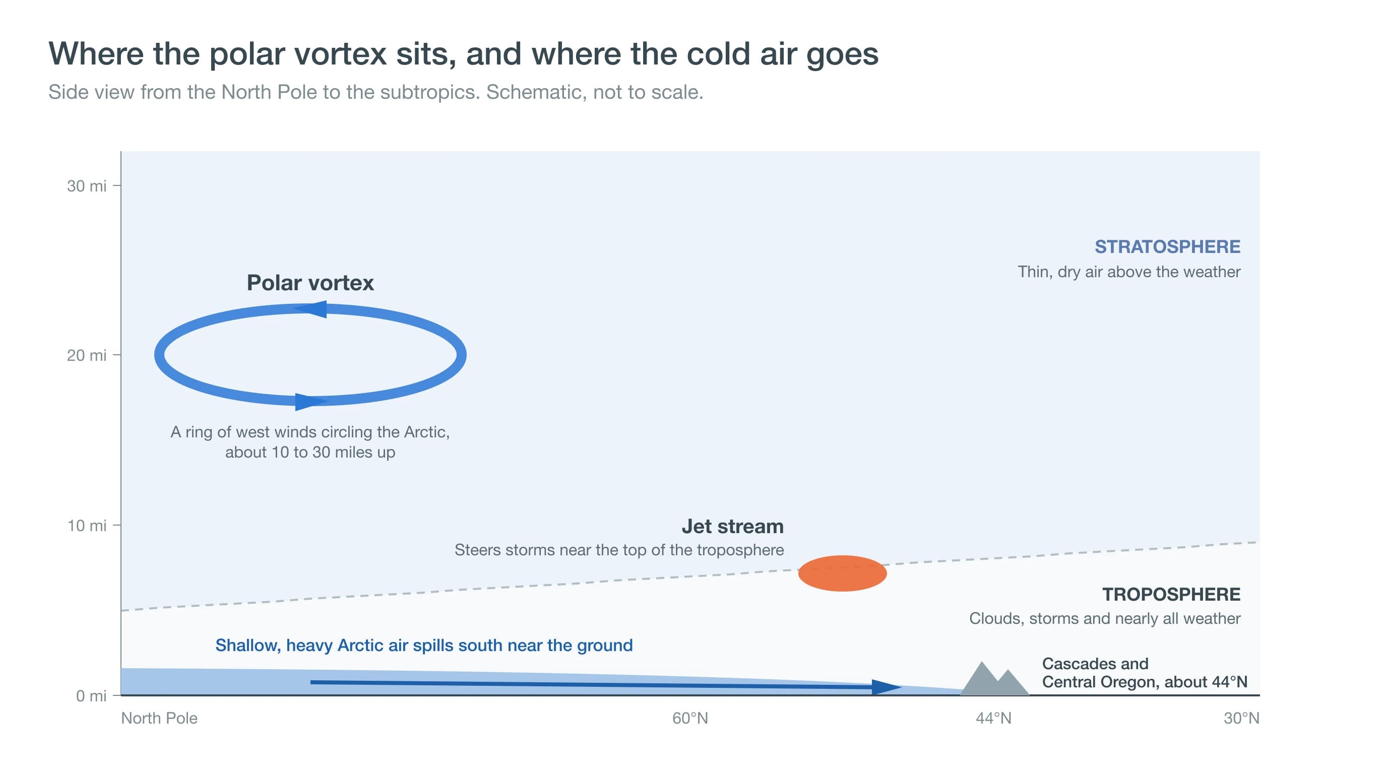
The polar vortex spins around the North Pole each winter, about 10 to 30 miles above the ground. NOAA's Climate.gov places it in the stratosphere, the layer of air above the one where clouds, storms and airliners are found. The ring works something like a fence, keeping the coldest air of the season penned up over the Arctic.
The weather we feel happens lower down, in the troposphere, the lowest 6 or 7 miles of the atmosphere. Near the top of that layer runs the jet stream, a fast river of wind that steers storms. It also marks the boundary between cold northern air and milder air to the south.
News reports often use "polar vortex" for any blast of Arctic air at the ground, while scientists use the term for the high ring of wind. The cold that reaches Oregon comes from Arctic air flowing south under a deep southward dip in the jet stream. That dip can form whether or not the vortex far above is disturbed.
Does the Polar Vortex Ever Reach Central Oregon?
Arctic air from the far north reaches Central Oregon a few times a decade, even though the vortex itself stays over the Arctic. Since 1950, Redmond Airport has dropped to -10°F or colder in about four separate cold snaps per decade.
These outbreaks usually begin when the jet stream bulges far north over the eastern Pacific and Alaska, a shape forecasters call a ridge. Downstream of that bulge, the jet stream dips south over western Canada and the interior West in a shape called a trough. Bitterly cold air from northern Canada then flows south beneath the dip.
In Bend and Redmond, an outbreak usually means clear skies, light wind and mornings far below zero. Daytime highs can stay in the teens or colder for several days, and a little dry, powdery snow sometimes falls as the cold air arrives.
Deep cold like this is the exception rather than the rule. Redmond Airport averages about three mornings a winter at or below zero, and close to a third of winters have none at all.
Why Does Arctic Air Hit Central Oregon Harder Than Portland?
Arctic air hits Central Oregon harder because it is shallow and heavy, so it flows around mountains rather than over them. A fresh Arctic air mass is often only a few thousand feet deep. It spreads south through interior British Columbia and eastern Washington, filling the Columbia Basin and the high desert east of the Cascades.
The Cascades block most of that cold from reaching western Oregon. The National Weather Service office in Spokane describes how the Columbia Basin traps cold air in winter. The Cascades wall it in on the west, and higher mountains close it off to the north. Portland and the Willamette Valley usually get a weaker version of the same air, often as an east wind pouring out of the Columbia River Gorge.
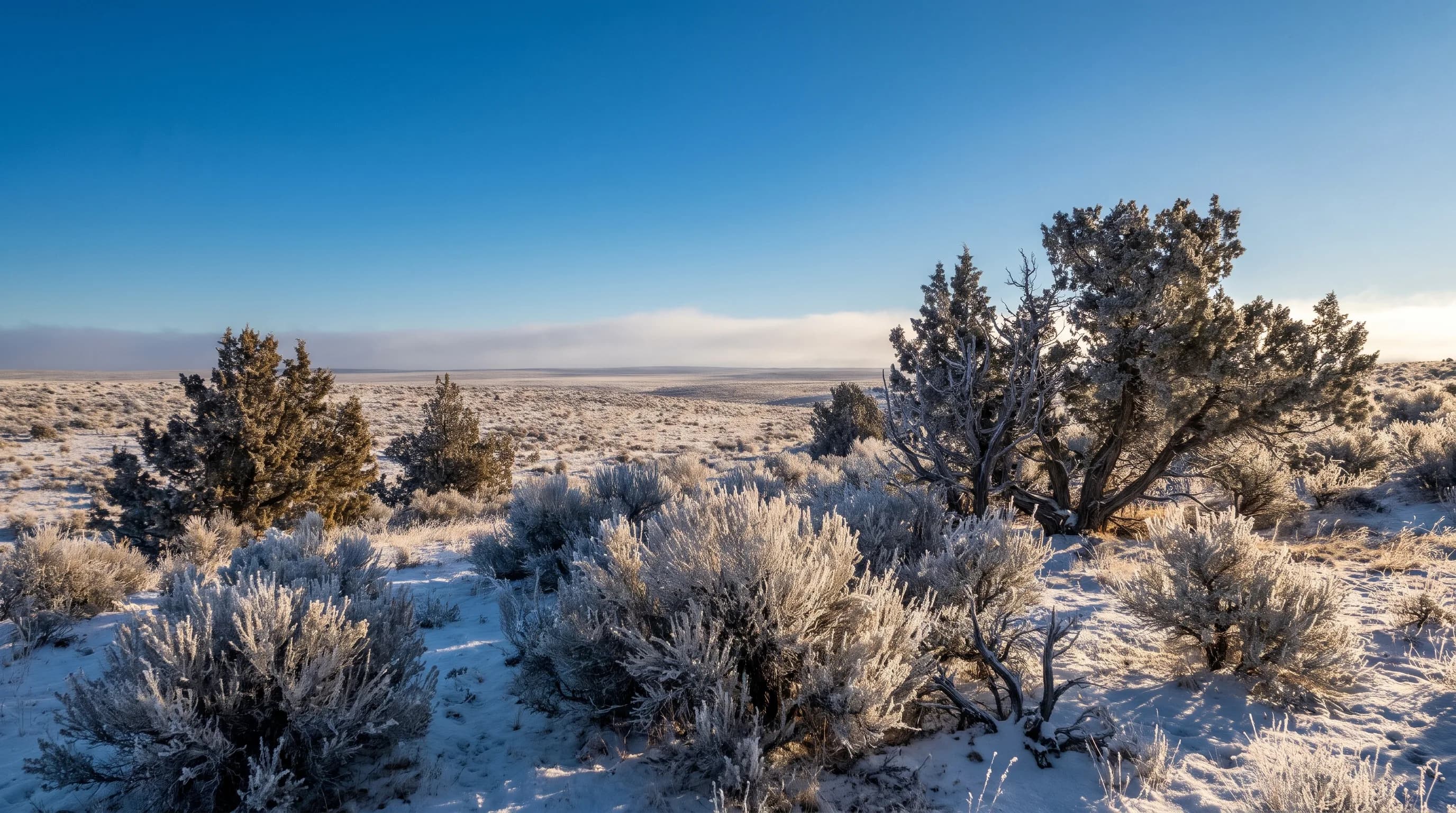
Once the Arctic air arrives, the high desert makes it colder still. Dry air and clear skies let the ground lose heat quickly at night. Snow cover makes it worse, because snow sheds heat easily at night and shields the air from the warmer soil underneath.
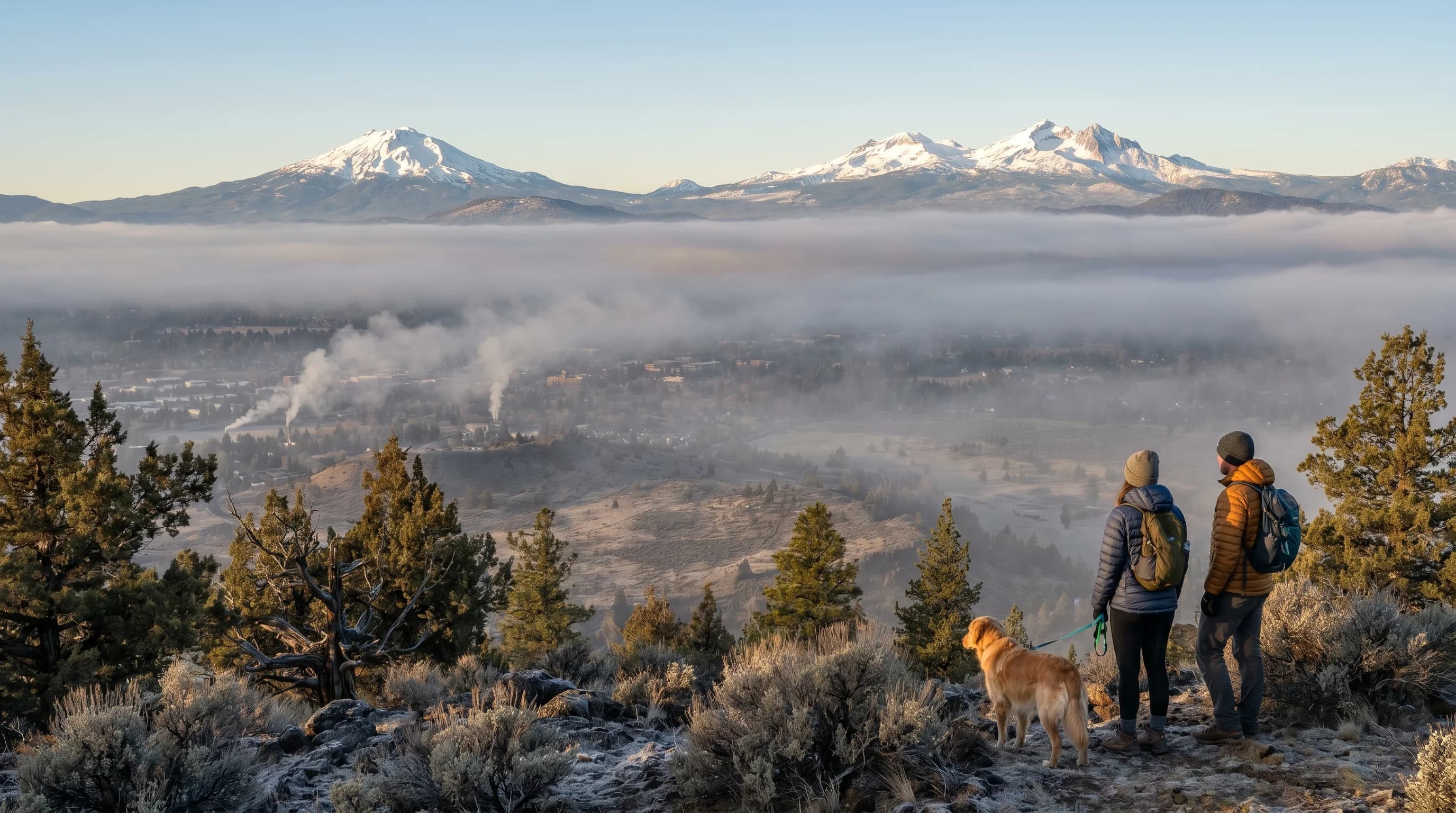
The coldest air then drains into low, open ground, which is why Redmond Airport often reads colder than Bend during the same outbreak. In mid-November 2014, Redmond fell to -19°F while Bend stayed just above zero. Our guide to temperature inversions in Central Oregon explains how cold air pools in the basin on still nights.
How Cold Has It Gotten in Central Oregon's Arctic Outbreaks?
The deepest outbreak at Redmond Airport came in December 1972, when the temperature fell to -28°F. That is the airport's lowest reading since its record began in 1948, and the bitter cold lasted about five days.
Deep cold is not only a thing of the distant past. In December 2013, Redmond dropped to -27°F, one degree short of its record, while Bend bottomed out at -15°F.
| Outbreak | Redmond Airport low | Bend low |
|---|---|---|
| January 1950 | -24°F | -26°F |
| January 1962 | -27°F | -24°F |
| December 1972 | -28°F | -24°F |
| December 1978 | -20°F | -16°F |
| February 1989 | -19°F | -17°F |
| December 1990 | -24°F | -18°F |
| December 2013 | -27°F | -15°F |
| November 2014 | -19°F | 2°F |
Lowest daily temperature during each outbreak. Source: NOAA Applied Climate Information System (ACIS) daily data for Redmond Airport (record from 1948) and the Bend cooperative station (record from 1901).
Outbreaks can also arrive before winter officially starts, and Redmond's -19°F in mid-November 2014 is its coldest November reading on record. Bend's own lowest reading is -26°F, reached in February 1933 and again in January 1950. For the coldest temperatures ever measured across the state, see our guide to Oregon weather records.
What our analysis found
- Since 1950, Redmond Airport has fallen to -10°F or colder in about four separate cold snaps per decade, and to -20°F or colder about once a decade.
- Over the 29 winters from late 1991 to early 2020, Redmond averaged about three mornings a winter at or below 0°F, and 9 of those winters had none.
- None of Redmond's 13 cold snaps of -14°F or colder since 1958 came within 60 days after one of the 42 major polar vortex disruptions NOAA lists for 1958 to 2023.
- In the 60 days after each of those disruptions, Redmond's coldest reading was -12°F or milder.
CentralOregonWeather analysis of NOAA ACIS daily low temperatures for Redmond Airport (1948 to 2026) and Bend (1901 to 2026), compared with major sudden stratospheric warming dates from the NOAA Chemical Sciences Laboratory compendium (ERA5 dates, 1958 to 2023). Cold snaps less than a week apart were counted as one.
Deep Dive: Does a Polar Vortex in the News Mean Cold Weather in Bend?
A polar vortex in the news does not reliably mean cold weather in Bend, and any effect takes weeks to arrive. A disrupted vortex raises the odds of Arctic outbreaks somewhere in the Northern Hemisphere. Where the cold actually lands depends on the jet stream pattern underneath, and the Pacific Northwest is often not the favored target.
What Happens When the Polar Vortex Breaks Down?
A breakdown starts when huge waves in the lower atmosphere push upward into the stratosphere. These waves are giant north and south meanders in the flow of air. Mountain ranges like the Rockies set them up, and so does the contrast between cold continents and warmer oceans. As they break high over the Arctic, they slow the vortex's west winds and warm the air over the pole.
When the winds about 19 miles up actually reverse and blow from the east, scientists call the event a sudden stratospheric warming. The air high over the pole can warm by tens of degrees within days. During one warming pulse in January 2024, NASA's Global Modeling and Assimilation Office found a rise of about 72°F (40°C) in the middle stratosphere over the North Pole.
After a warming, the vortex either drifts off the pole or splits into two smaller spinning pieces. NOAA's Chemical Sciences Laboratory keeps a list of these major disruptions. It counts 42 of them from 1958 to 2023, or about six per decade.
How Does a Change 19 Miles Up Reach the Ground?
The effect reaches the ground slowly and loosely, over a few weeks. Atmospheric scientists Mark Baldwin and Timothy Dunkerton described the process in a 2001 paper in the journal Science. They tracked strong and weak vortex events as the changes worked down through the stratosphere. Surface weather patterns shifted afterward and stayed changed for up to about two months.
A weak vortex tends to push the jet stream south and make it wavier, which raises the odds of Arctic outbreaks. Amy Butler, a NOAA research scientist who studies the stratosphere, has written about this on Climate.gov. Disruptions can bring cold outbreaks to much of Europe, Asia and the eastern United States, she notes. She also stresses that the vortex is only one of many influences on winter weather.
A different kind of disruption, called a stretched vortex, has been tied to cold in North America and Asia. Judah Cohen of Atmospheric and Environmental Research and his colleagues described it in Science in 2021. The vortex stretches into a long oval instead of breaking down, and they linked that shape to extreme cold including the February 2021 Texas freeze. Other scientists still debate how much Arctic warming drives these events.
Why Do Central Oregon's Worst Cold Snaps Skip the Polar Vortex?
Central Oregon's worst cold snaps come from the jet stream pattern over the North Pacific and western Canada. That pattern can send Arctic air south with or without any help from the stratosphere. We compared Redmond Airport's daily lows with NOAA's list of major vortex disruptions to see how often the two lined up.
By our calculation, none of Redmond's 13 cold snaps of -14°F or colder since 1958 came within two months after a disruption. In the 60 days after each of the 42 disruptions, Redmond never fell below -12°F, far from its record of -28°F.
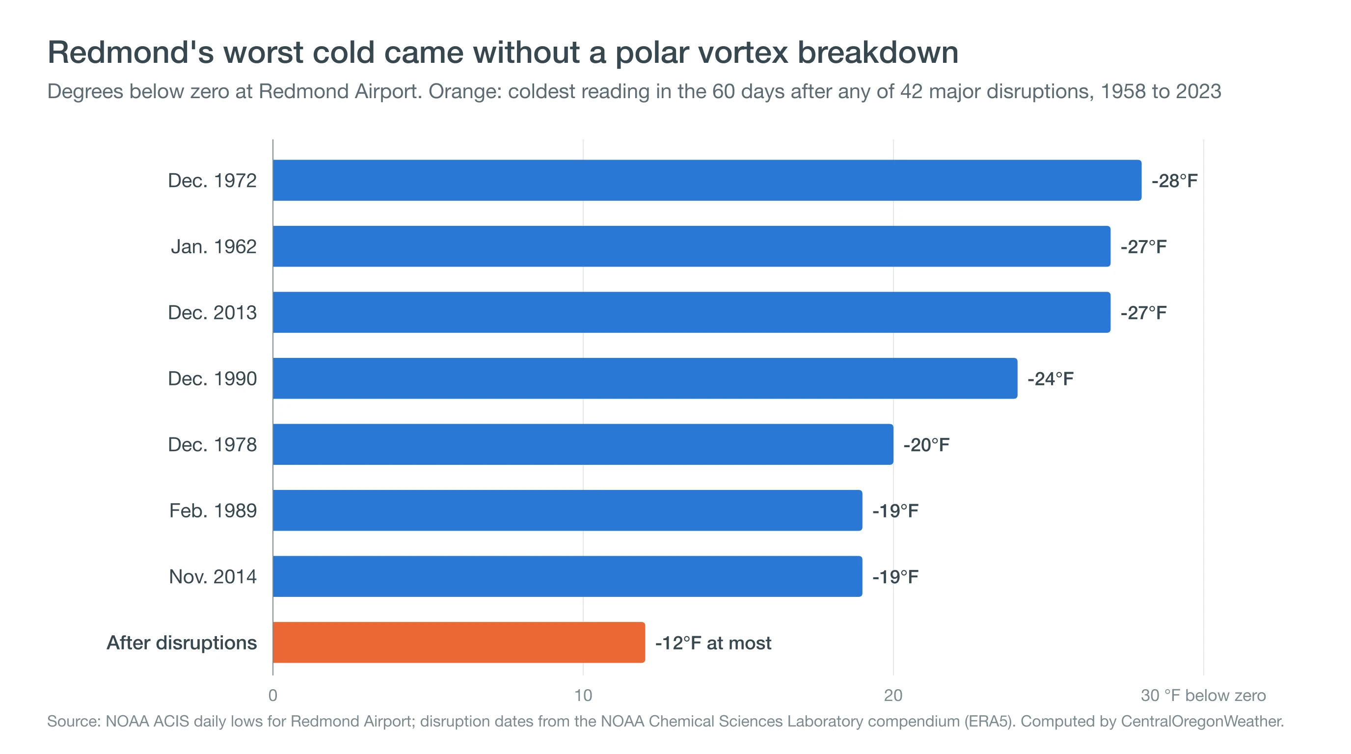
Six of those cold snaps, including the record cold of December 1972, came in the two months before a disruption instead. One possible explanation is that a strongly buckled jet stream does two things at once. It sends Arctic air down the interior West, and it pushes waves upward that help knock the vortex over. Lorenzo Polvani and Darryn Waugh found in a 2004 study in the Journal of Climate that bursts of upward-moving waves come before the vortex's extreme weak events.
For Central Oregon, the deepest cold needs a ridge off the coast and a path for Arctic air down the interior. It also needs the Cascades to hold that air on the east side, and clear, snowy nights to chill it further. A polar vortex disruption can raise the odds of Arctic outbreaks across the hemisphere, but it does not decide where the cold goes.
How Do You Prepare for an Arctic Blast in Central Oregon?
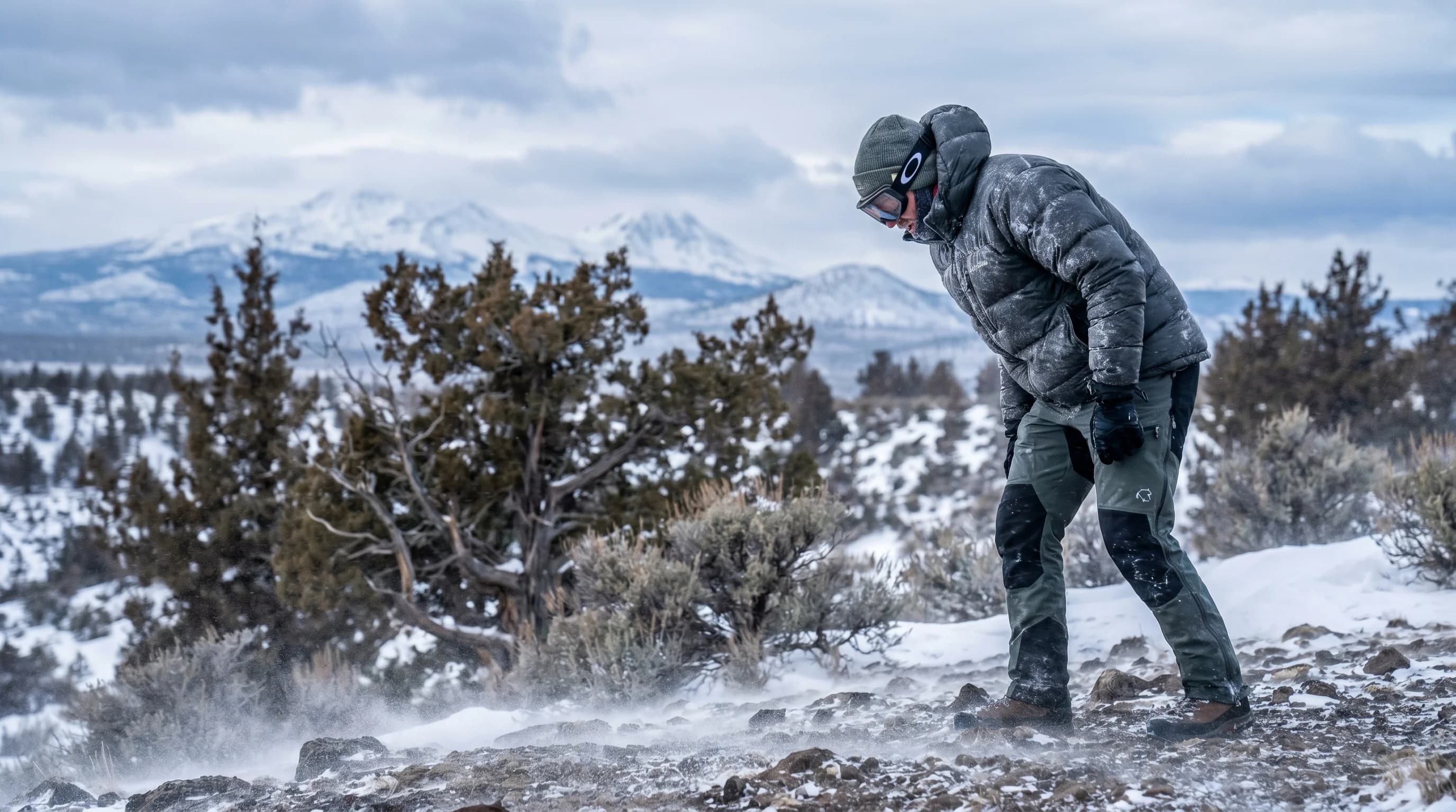
Protect people and pets first, since extreme cold can hurt anyone who stays outside too long. Check on older neighbors, bring pets and outdoor animals into shelter, and wear layers with a hat and gloves even for short trips. Wind makes the cold bite faster, and our guide to wind chill explains how quickly exposed skin can freeze.
For pipes, a common rule of thumb comes from the University of Illinois Building Research Council. Its tests, cited by the Insurance Institute for Business & Home Safety, found that uninsulated pipes in unheated spaces start to freeze near 20°F outside. When lows are forecast below that, let faucets on outside walls drip, open cabinet doors under sinks and disconnect garden hoses. Pipes in drafty spots can freeze even sooner, especially when wind gets in.
For driving, keep the tank at least half full and carry a winter kit with blankets, water, a flashlight and traction devices. Cold weakens car batteries, so an older battery is worth testing before the outbreak arrives. Calm, frigid nights can also bring freezing fog and icy roads in the basin, and our guide to Cascade mountain passes in winter covers conditions over the crest.
Before an Arctic blast, check the overnight low and wind chill for your town on the CentralOregonWeather map. The National Weather Service office in Pendleton issues cold weather advisories for the region. For a sense of how a normal winter compares, see our guide to Bend weather in January.