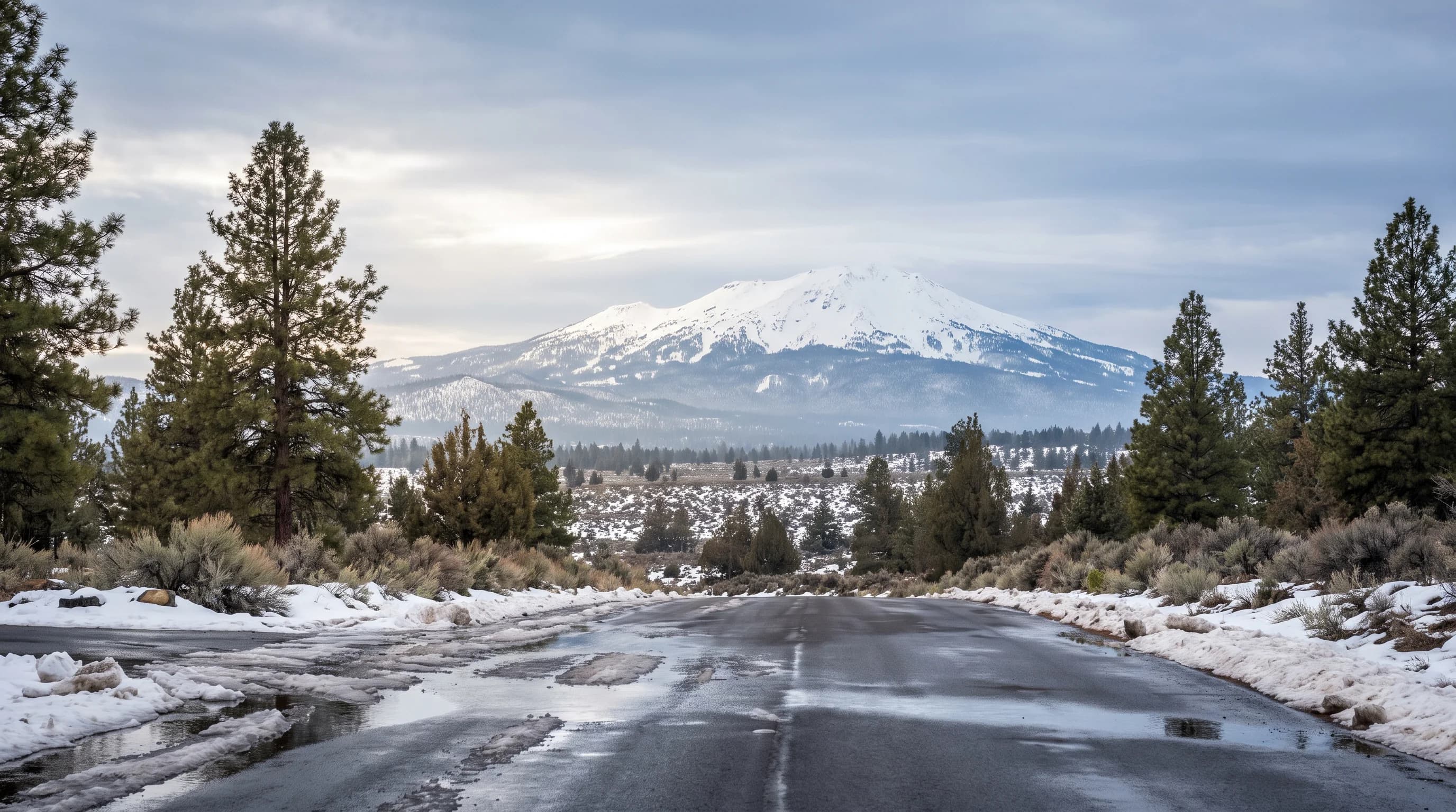
Warmer-than-normal temperatures are more likely in Central Oregon during winter 2026-27, but NOAA is not predicting a clearly wetter or drier season. For December through February, Bend falls within NOAA's 40-50% above-normal temperature band, while above-normal, near-normal, and below-normal total precipitation remain equally likely. If the seasonal warmth also appears during storms, higher snow levels could shift more precipitation toward rain or slush in Bend and Redmond. NOAA does not issue a seasonal snowfall outlook for Bend or Mt. Bachelor.
At the same time, El Niño is strengthening. The NOAA Climate Prediction Center said on September 10 that El Niño was strengthening, with a greater than 90% chance of a very strong event during fall and winter 2026-27. That probability describes the tropical Pacific pattern, not the chance of a historic Bend winter. Central Oregon's actual outcome will still depend on the storm track, storm temperature, and snow level.
What Does the 2026-27 El Niño Mean for Central Oregon?
El Niño is the warm phase of the El Niño-Southern Oscillation, or ENSO, a recurring pattern in the tropical Pacific Ocean and atmosphere. It can shift the Pacific jet stream and change where winter storms travel. That makes El Niño useful seasonal context, but it cannot say whether a specific January storm will bring rain to Bend, powder to Mt. Bachelor, or both.
NOAA's September 17 seasonal outlook translates that broad climate pattern into local probabilities. Warmth is the clearest Central Oregon signal, while Bend remains in NOAA's equal-chances precipitation area through December-February.
| Question | Current answer | Important limit |
|---|---|---|
| Warm or cold winter? | Warmer than normal is more likely | Cold snaps and individual snowstorms remain possible |
| Wetter or drier? | No clear winter outcome | NOAA shows equal chances for total precipitation |
| Could more storms fall as rain in town? | Possible if snow levels run higher | This is an implication of warmth, not a forecast for more rain |
| Less snow in Bend? | Possible if storms run warm | NOAA does not provide a seasonal Bend snowfall probability |
| Less snow at Mt. Bachelor? | Too uncertain to call | High elevations can still receive major snowstorms |
Source: NOAA Climate Prediction Center, issued September 17, 2026.
Is Central Oregon Likely to Have a Warm or Cold Winter?
A warmer winter is more likely. NOAA's September maps place Bend in the 40-50% above-normal temperature band for December-February, down from 50-60% in August. Sisters is also in the 40-50% band, while Redmond remains at 50-60%. The chance of a warmer winter has eased for Bend, but warmth is still more likely than either a near-normal or colder winter. Bend stays in the 40-50% band for January-March and February-April.
A 40-50% probability does not mean the winter will be 40-50% warmer, and it does not specify how many degrees above normal Bend will finish. NOAA divides past seasons into three groups: the warmest third, middle third, and coldest third. A 40-50% chance of above-normal temperatures means the warmest-third outcome is more likely than either of the other two individual categories. It is a probability for the three-month average, not a forecast for every day.
| Three-month period | Chance of warmer than normal | Total precipitation |
|---|---|---|
| Oct-Dec 2026 | 40-50% | Equal chances |
| Nov 2026-Jan 2027 | 50-60% | Equal chances |
| Dec 2026-Feb 2027 | 40-50% | Equal chances |
| Jan-Mar 2027 | 40-50% | 33-40% chance of above normal |
| Feb-Apr 2027 | 40-50% | Equal chances |
| Mar-May 2027 | 33-40% | Equal chances |
Source: NOAA Climate Prediction Center, issued September 17, 2026. These are NOAA's probability bands at Bend. Redmond and Sisters remain in the equal-chances precipitation area for January-March. Precipitation includes rain and the water contained in snow; these are not snowfall probabilities.
Central Oregon can still have severe cold during a season that finishes warm overall. A few days of Arctic air, a cold east wind, or a nighttime inversion can produce very low temperatures even if milder periods win out over three months. The region's tendency to trap cold air near the ground is explained in the Central Oregon temperature-inversion guide. A warm seasonal outlook changes the balance of the winter, not the possibility of cold.
Is Central Oregon Likely to Receive More or Less Rain?
NOAA does not currently identify a wetter or drier outcome as more likely for Central Oregon during the core winter. Bend is in the equal-chances category for precipitation from fall through the core winter of December-February. Equal chances does not mean NOAA expects average precipitation. It means the forecast does not give above-normal, near-normal, or below-normal totals a meaningful advantage over the other categories. A very wet or very dry season remains possible.
Bend remains in NOAA's lowest above-normal precipitation band in the January-March map, at 33-40%. Redmond and Sisters remain in the equal-chances area. That small difference is not enough to describe all of Central Oregon as likely wet, and Bend returns to equal chances for February-April. NOAA's national maps show a stronger wet signal farther south and a drier signal farther north and inland, leaving Central Oregon near a less certain boundary.
Precipitation includes both rain and the melted water contained in snow. A winter can finish near normal for total precipitation while producing less snow in town if more storms arrive with temperatures just above freezing. The same total amount of water can fall as rain in Bend and snow higher in the Cascades, so the precipitation category alone does not answer the question most residents and skiers care about.
Does a Warmer El Niño Winter Mean Less Snow in Bend and Redmond?
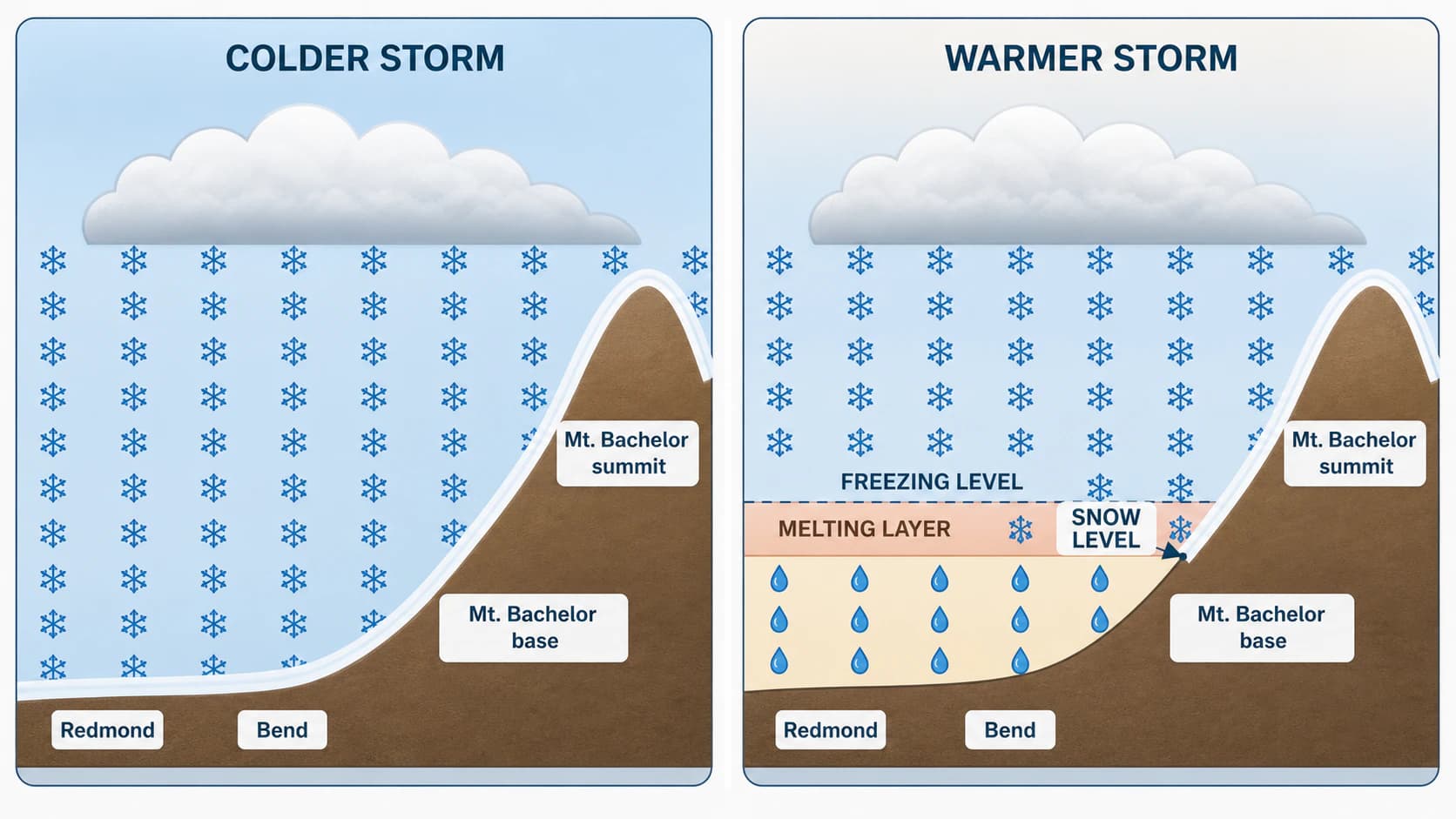
It can raise the risk of less or shorter-lived snow in town if the seasonal warmth also appears during storms, but snow remains possible. Bend sits at about 3,600 feet and Redmond near 3,000 feet, elevations that often land close to the rain-snow line during Pacific storms. When the snow level rises above town, a storm that might otherwise produce snow arrives as rain, wet snow, or slush. When the snow level drops below town, the same storm can quickly turn white.
If the warmer seasonal pattern also appears during individual storms, higher snow levels would be a greater concern. Mild periods could also help snow melt between storms, shortening the time that accumulation stays on streets, yards, and trails. But the seasonal average cannot rule out a cold storm that drops several inches in Bend or creates difficult driving around Redmond. The Bend snowfall and winter-driving guide explains how quickly the city can switch between dry pavement, slush, and accumulating snow.
Sunriver's higher elevation can help it hold snow longer than Bend or Redmond. Sisters is lower than Bend but sits closer to the Cascades, where storm conditions can differ. Neither community is protected from warm storms. A snow level near 4,500 or 5,000 feet can bring rain or mixed precipitation to lower-elevation communities while snow continues in the higher Cascades. The key question for every storm will be where the snow level sits, not simply whether El Niño is active. Our guide to the Oregon snow-level map shows how to read that number before a storm arrives.
What Could El Niño Mean for Mt. Bachelor and Cascade Snowpack?
The current outlook does not clearly point to either an above-normal or below-normal Mt. Bachelor snow season. Total precipitation has no clear winter direction, and the mountain spans a large elevation range. Its base areas sit around 6,300 to 6,500 feet, while the summit reaches 9,068 feet. A warm storm can bring rain or wet snow near the base while the upper mountain receives heavy snow, which is why a single resort-wide snow number can hide very different conditions from bottom to top.
Warmer storms can affect snow quality and snowpack even when they deliver plenty of water. Higher snow levels reduce the portion of a storm that falls as snow at lower elevations. Wet snow can compact more quickly, warmer storms can add rain on top of existing snow, and mild breaks between storms can cause melting. On the other hand, a series of colder storms can still build a deep upper-mountain base during an otherwise warm winter. The Mt. Bachelor weather guide covers the base-to-summit differences that matter on any given day.
Spring snow-water equivalent, the amount of liquid water stored in the snowpack, will ultimately depend on how many storms arrive, how cold they are, how much wind redistributes the snow, and how much melting occurs between them. That is why the seasonal ENSO signal should not be treated as an April snowpack forecast. Once snow begins accumulating, actual mountain measurements will be more useful than an El Niño comparison. The broader differences between snow in town and Cascade snow are covered in the Central Oregon snow guide.
How Can a Very Strong El Niño Still Produce a Snowy Central Oregon Winter?
El Niño changes seasonal odds, not the path of every storm. The Pacific jet stream can shift north or south for days or weeks at a time, and a cold, moisture-rich system can still move directly into Oregon. One or two active periods can produce a large share of a town's winter snowfall or a ski area's seasonal snowfall, even if long mild stretches occur before or afterward.
NOAA's September strength outlook gives October-December a 98% chance of a very strong El Niño, which means a three-month Relative Oceanic Niño Index, or RONI, of at least +2.0°C. RONI compares sea-surface temperature departures in the east-central equatorial Pacific with departures across the broader tropical oceans. In its September 10 diagnostic discussion, NOAA separately gives that season a 75% chance of reaching +2.5°C or higher, a level it says would exceed previous events in its record back to 1950. News coverage often calls an event this strong a "super El Niño." NOAA's own term is a very strong El Niño, and the label describes the tropical Pacific, not the size of Central Oregon's winter.
NOAA also warns that a stronger El Niño does not guarantee a stronger local impact. Those percentages cannot be converted into Bend snowfall, Mt. Bachelor base depth, or the number of winter storms. ENSO is the background pattern. The exact jet-stream position, the air mass attached to each storm, and Central Oregon's elevation differences determine the weather people actually experience.
This uncertainty works in both directions. A warm winter can still produce a memorable snowstorm, and a season with near-normal precipitation can still leave the lower-elevation snowpack below normal. It is more accurate to say warmth is more likely this winter and higher snow levels are possible during mild storms than to declare it a low-snow winter before the storms have arrived.
What Did Past Strong El Niño Winters Bring to Central Oregon?
Past strong El Niño winters were reliably mild in Central Oregon but split on snow. At Redmond Airport, all six strong events since 1982 brought a warmer-than-normal December through February, by 1.1°F to 3.7°F. Mountain snowpack on April 1 ranged from about a third of normal to half again above normal at two SNOTEL sites near Mt. Bachelor.
The three strongest events on record, 1982-83, 1997-98 and 2015-16, are the closest matches to a super El Niño. None of them left a poor spring snowpack near Mt. Bachelor: April 1 snow water ranged from 88% to 153% of the median. The worst El Niño snow year in this set, 1991-92, came from a weaker event, with April 1 snowpack near a third of normal. Event strength did not line up with snowpack.
| Winter | Peak ONI | Redmond Dec-Feb temperature | Redmond Nov-Mar precipitation | Apr 1 snowpack, Three Creeks Meadow | Apr 1 snowpack, Irish Taylor |
|---|---|---|---|---|---|
| 1982-83 | +2.1 | +1.8°F | 130% | 153% | 123% |
| 1991-92 | +1.5 | +3.5°F | 67% | 30% | 37% |
| 1997-98 | +2.4 | +3.1°F | Incomplete record | 106% | 88% |
| 2009-10 | +1.5 | +1.1°F | 83% | 107% | 81% |
| 2015-16 | +2.6 | +2.4°F | 123% | 93% | 107% |
| 2023-24 | +2.0 | +3.7°F | 122% | 68% | 119% |
Sources: peak Oceanic Niño Index from the NOAA Climate Prediction Center; Redmond Airport (USW00024230) monthly records via the Applied Climate Information System, compared with the winters of 1990-91 through 2019-20; April 1 snow water equivalent from NRCS SNOTEL Three Creeks Meadow (5,680 ft, about 12 miles north of Mt. Bachelor) and Irish Taylor (5,540 ft, about 18 miles southwest), as a percent of the 1991-2020 median. Computed by CentralOregonWeather. A strong event here has a peak ONI of +1.5 or higher.
Central Oregon also enters this El Niño after a snow drought. On April 1, 2026, the six SNOTEL sites from Santiam Pass to Willamette Pass held between 1% and 14% of their median snow water. That deficit belongs to last winter, not to El Niño, but it means the region starts this winter short on stored mountain water. A near-normal snowpack in 2026-27 would be a real recovery, not merely an average year.
What Should Residents, Drivers, and Skiers Watch Next?
NOAA updated its local temperature and precipitation outlook on September 17, 2026. The next El Niño update is scheduled for October 8, and the next seasonal outlook is due October 15.
Once winter begins, use seasonal information for context and near-term forecasts for decisions. The National Weather Service in Pendleton provides short-range forecasts, watches, and warnings for much of Central Oregon. Check the expected snow level, storm timing, and road conditions before driving toward the Cascades. For the mountain water picture, NRCS SNOTEL measurements show how much water is actually stored in the snowpack.
A useful routine is simple: check NOAA for the broad seasonal direction, then check the local forecast before every storm. El Niño can tell you why a warmer pattern is more likely. It cannot tell you whether next Saturday will bring rain in Bend or powder at Mt. Bachelor.
What Is the Bottom Line for Central Oregon's 2026-27 Winter?
Warmer-than-normal temperatures are more likely in Central Oregon this winter. NOAA does not currently show a clear wetter-or-drier outcome for December through February, and it does not provide a seasonal snowfall forecast for Bend or Mt. Bachelor. If individual storms run warmer, higher snow levels could shift more precipitation toward rain at lower elevations, while the higher Cascades can still receive major snowstorms whenever cold air and Pacific moisture line up.