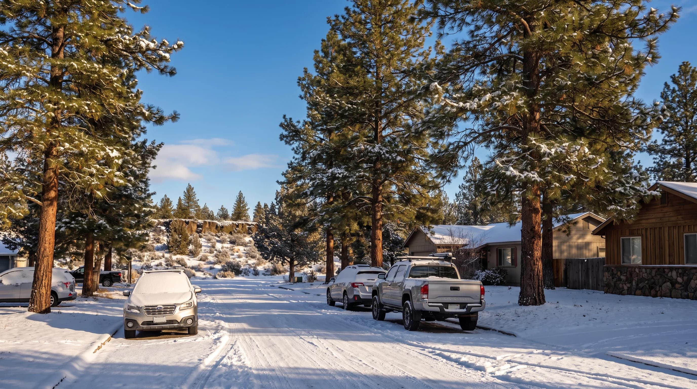
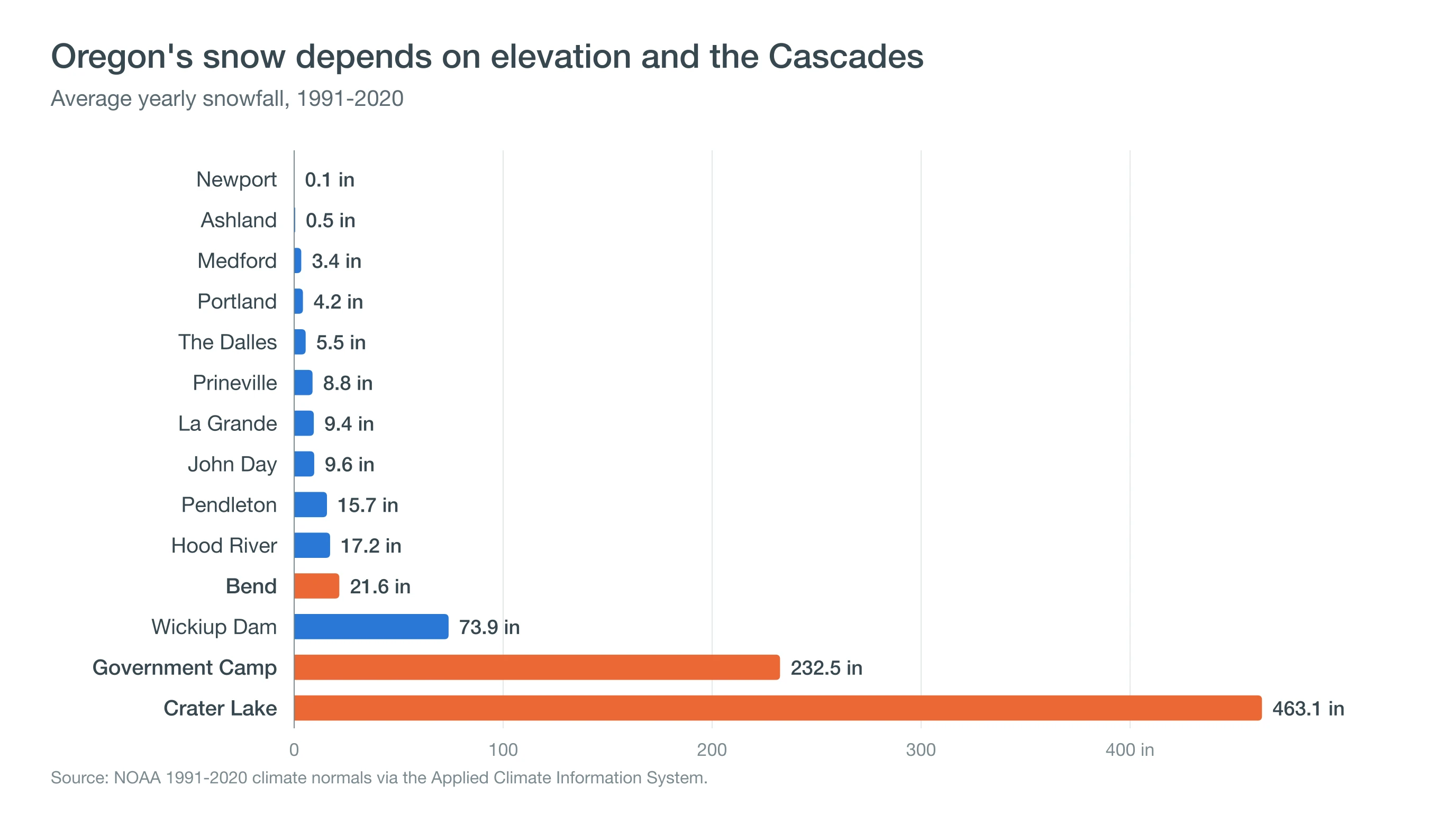
Yes, it snows in Oregon, but amounts vary more than a hundredfold across the state. NOAA's 1991-2020 normals give Portland about 4 inches of snow a year, Medford about 3 and Newport almost none, while Bend gets about 22, Government Camp about 233 and Crater Lake about 463. East of the Cascades and above about 3,000 feet, snow is a normal part of winter.
Oregon's snow follows two lines on a map: the crest of the Cascades and the elevation contour. West of the crest and close to sea level, snow is a rare event that can shut down a city. East of the crest, or high enough on any mountain, it is simply the season. The same January storm can bring rain to Portland, a few inches to Bend and two feet to Government Camp.
Does It Snow in Oregon?
It snows somewhere in Oregon every winter, and in the mountains it snows a lot. The table below ranks long-record weather stations from least to most snow. Notice that elevation and side of the mountains predict the order far better than latitude does: Medford, in the south, gets less snow than Portland, while The Dalles and Hood River, in the Columbia Gorge where cold air from the interior pools, get more.
| City or site | Region | Station elevation | Snow per year |
|---|---|---|---|
| Newport | Coast | 122 ft | 0.1 in |
| Ashland | Southern Oregon | 1,729 ft | 0.5 in |
| Medford | Southern Oregon | 1,313 ft | 3.4 in |
| Portland | Willamette Valley | 22 ft | 4.2 in |
| The Dalles | Columbia Gorge | 150 ft | 5.5 in |
| Prineville | Central Oregon | 2,876 ft | 8.8 in |
| La Grande | Eastern Oregon | 2,755 ft | 9.4 in |
| John Day | Eastern Oregon | 3,063 ft | 9.6 in |
| Pendleton | Eastern Oregon | 1,485 ft | 15.7 in |
| Hood River | Columbia Gorge | 500 ft | 17.2 in |
| Bend | Central Oregon | 3,660 ft | 21.6 in |
| Wickiup Dam (near La Pine) | Central Oregon | 4,359 ft | 73.9 in |
| Government Camp | Cascades | 3,980 ft | 232.5 in |
| Crater Lake | Cascades | 6,485 ft | 463.1 in |
NOAA 1991-2020 climate normals for each station, via the Applied Climate Information System. Airport stations are used for Portland, Medford and Pendleton; Crater Lake is the national park headquarters station.
The biggest surprise for newcomers is how little snow the big western cities get.
Does It Snow in Portland and the Willamette Valley?
Yes, but rarely. Portland International Airport averages 4.2 inches a year, most of it in January (1.7 inches), December and February (1.2 inches each). Salem and Eugene see similar small totals, usually from one or two storms. Many winters bring only a dusting, and some bring none.
The reason is the ocean. Pacific air keeps the Willamette Valley near 40°F through most winter storms, a few degrees too warm for snow. Valley snow usually needs cold air from east of the Cascades to pour west through the Columbia River Gorge first, then a Pacific storm to ride over that cold layer. When that happens, the result can be snow, or the more dangerous mix of freezing rain and ice. Our guide to freezing rain, sleet and snow explains how a cold layer near the ground changes what falls.
Cross the Cascades and the picture flips.
Why Does Central Oregon Get So Much More Snow Than Portland?
Central Oregon gets more snow because it is higher and colder, even though it is drier. Bend sits at about 3,600 feet, more than 3,500 feet above Portland, and on the continental side of the mountains, where clear winter nights let heat escape and cold air settles into basins. The Cascade rain shadow means Bend gets far less precipitation than Portland, about 10.6 inches a year against roughly 37, but a much larger share of Bend's winter precipitation falls as snow.
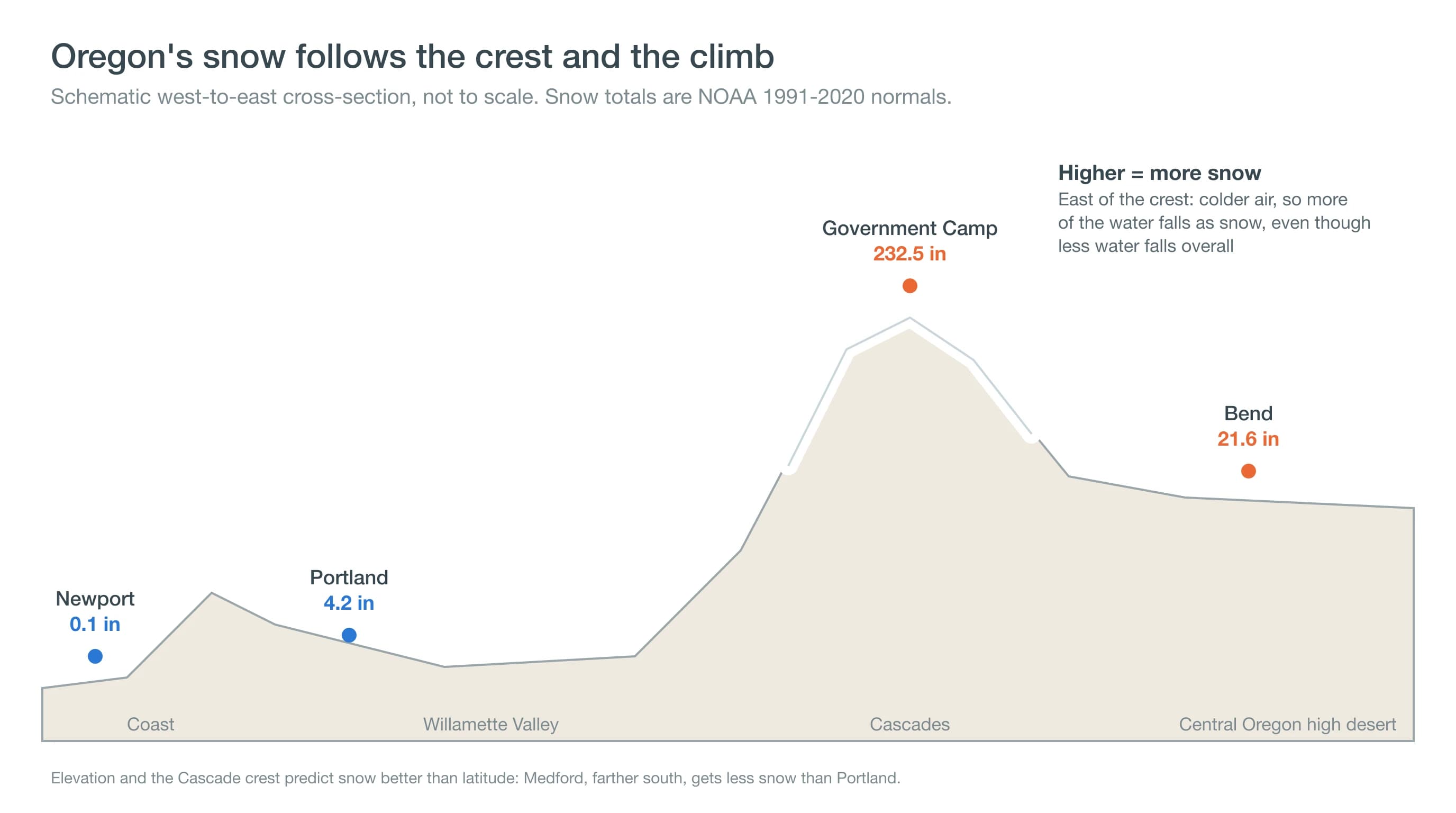
Within Central Oregon, small differences in elevation matter a lot. Madras, at about 2,240 feet, averages around 5 inches a year; Prineville, at 2,900 feet, 8.8 inches; Bend, 21.6 inches; Sisters, closer to the mountains, about 30; and Sunriver, at 4,160 feet, more than 60 (the Madras, Sisters and Sunriver figures are computed from partial co-op records). Our guide to how much snow Bend gets breaks down the city winter by winter.
Snow also lasts longer as you climb. In an average January, snow covers the ground on about 9 days in Bend but about 26 days in Sunriver and at Wickiup Dam near La Pine, where cold air pools on clear nights and keeps each storm's snow from melting (computed from co-op daily records, 1991-2020).
The deepest snow, though, sits between the two halves of the state.
Where Does It Snow the Most in Oregon?
The Cascades get by far the most snow in Oregon. Crater Lake National Park headquarters, at 6,485 feet, averages about 463 inches a year, more than 38 feet, and its snow can arrive in any month but July and August. Government Camp on Mt. Hood averages about 233 inches. Near the passes that connect Central Oregon to the valley, Odell Lake averages about 190 inches.
Eastern Oregon's mountains are snowy too. The Blue and Wallowa mountains catch storms that have already crossed the Cascades and get enough snow to support ski areas such as Anthony Lakes, though their valleys, like La Grande and John Day, average under 10 inches a year.
These mountain totals are why Oregon has ski areas from Mt. Hood to Mt. Ashland and why the Cascade passes need chains so often. They also feed the state's rivers. Snow that piles up in the Cascades all winter melts in spring and summer, which is why water managers watch the snowpack so closely. Our El Niño outlook for Central Oregon covers what this winter could bring to the Cascade snowpack.
Snow totals tell you how much. The calendar tells you when.
When Does It Snow in Oregon?
In the valleys and on the coast, snow is mostly a December-to-February event. Portland's snowiest month is January, and Medford's is February. Central Oregon's snow season runs longer, from November into March: Bend's snowiest month is January (6.4 inches on average), with February (5.5) and December (5.3) close behind, and snow in October or April is possible in most years. East of the mountains, Pendleton's snowiest month is December.
The Cascades run on a different calendar. Government Camp averages about 30 inches of snow in November and still gets about 18 inches in April. At Crater Lake, the season stretches from September to June. If you want snow in spring, go up, not east.
Where Can You Go to See Snow in Oregon?
The surest bets are the ski areas and Sno-Parks of the Cascades from late November to April. From Bend, the Sno-Parks along the Cascade Lakes Highway, such as Virginia Meissner, Wanoga and Dutchman Flat, are less than an hour away, and Mt. Bachelor and Hoodoo offer lift-served snow. From Portland, Mt. Hood's Government Camp area is the closest snow. Oregon requires a Sno-Park permit to park at designated winter recreation areas; ODOT and local vendors sell them.
Check road conditions before you go. Snow that is fun to play in is the same snow that brings chain controls on the passes, and the Bend winter driving guide covers what to expect on Central Oregon roads.
Deep Dive: Why Does Snow Turn to Rain Partway Down a Mountain?
Snow turns to rain partway down a mountain because air warms as it sinks toward lower ground, and somewhere on the way down the falling flakes meet air warm enough to melt them. That boundary, the snow level, is the second of Oregon's two lines.
How Fast Does Air Cool With Height?
Dry air cools about 5.4°F for every 1,000 feet it rises. Air that is saturated, as it is inside a storm, cools more slowly, roughly 2.5°F to 3°F per 1,000 feet, because condensing water vapor releases heat. Apply that to a storm: from Portland, near sea level, to Government Camp, at about 4,000 feet, the air is roughly 10°F to 12°F colder. A 38°F rain in Portland can be snow on Mt. Hood.
Why Is the Snow Level Lower Than the Freezing Level?
The freezing level is where the air reaches 32°F; the snow level is where snow actually turns to rain, and it usually sits lower. Snowflakes take time to melt, so they survive several hundred feet into above-freezing air. The National Weather Service often uses about 1,000 feet below the freezing level as a rule of thumb. Melting itself pulls heat from the surrounding air, 334 joules for every gram of snow, so in heavy precipitation the storm can cool its own lower layers and drag the snow level down. Dry air helps too: when snow falls into dry air, evaporation chills the air toward its wet-bulb temperature, which is why cold, dry east-side air often lets snow reach Bend when a similar storm rains in the valley.
Why Is the East Side of the Cascades Colder in Winter?
East of the crest, the air is continental rather than marine. Skies clear more often, long winter nights let the ground radiate heat to space, and dense cold air drains into basins and valleys. That reservoir of cold air is what gives Central Oregon its routine snow, and when it spills west through the Columbia Gorge, it is what gives Portland its rare snow and ice storms.
How Should You Plan Around Snow in Oregon?
Remember the two lines. West of the Cascades and near sea level, plan for rain and treat snow as an event worth watching for; east of the crest or above about 3,000 feet, plan for snow as part of winter. Before a winter trip, check the snow level and expected totals on the Central Oregon snow forecast, look up pass conditions on ODOT TripCheck, and, if you are heading to the mountains to find snow, pack chains.